
 |
Being in the service division of my company, we frequently make reference to an acronym with the letters RTFM. It stands for Read The F@*&! Manual and it definitely applies to scrambling as well. The only thing I knew about this peak was that it required minimal altitude gain and that it could be done on a short day. At least that's what I remembered from a 3 min read back home. After departing Calgary at 6:30am, my partners Yuji, Kazumi, Mamiko and I arrived at the trailhead at 8:00am where we were greeted by a HUGE grizzly bear which crossed the highway and entered the forest near the trailhead. Needless to say, we were a little hesitant to begin but we decided to start so we could return to Calgary by mid afternoon. A quick hike up a well trodden path brought us to an open meadow where we continued up an obvious trail until we came to a vertical wall to the left. Definitely not the right way up. |
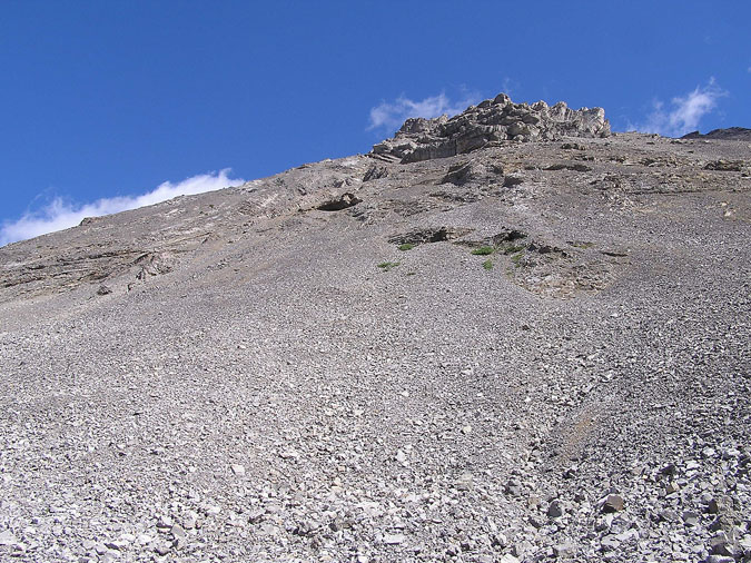 |
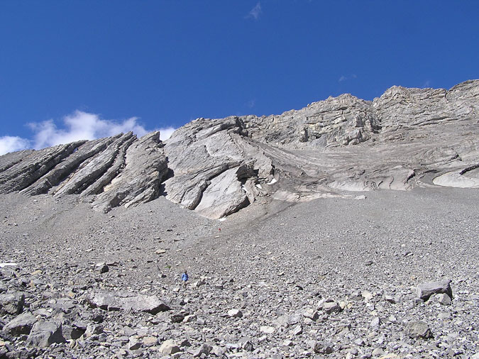
After realizing our obvious mistake, we decided to walk back down and return to the meadow to re-evaluate our position. On the way down, I heard a scream behind me and noticed that Mamiko had released a huge boulder at least 50cm wide. It missed Yuji by a few meters but I figured that a hit from that could take a person down like a bowling pin. What a close call! After retracing our steps back to the meadow, we realized that we should have gone left instead of right at one of the junctions. A faint set of tracks led us to the base of Mt. Arethusa where we were faced with a massive scree slope which was pretty pathetic. With no choice of routes, we simply picked a line in the scree and treadmilled upwards. |
 |
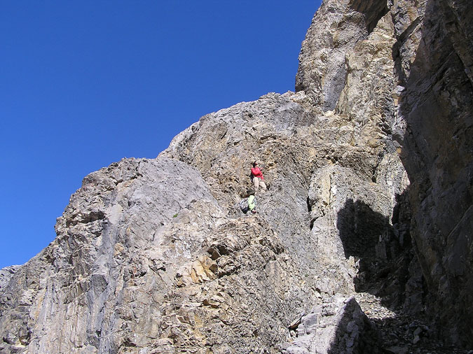
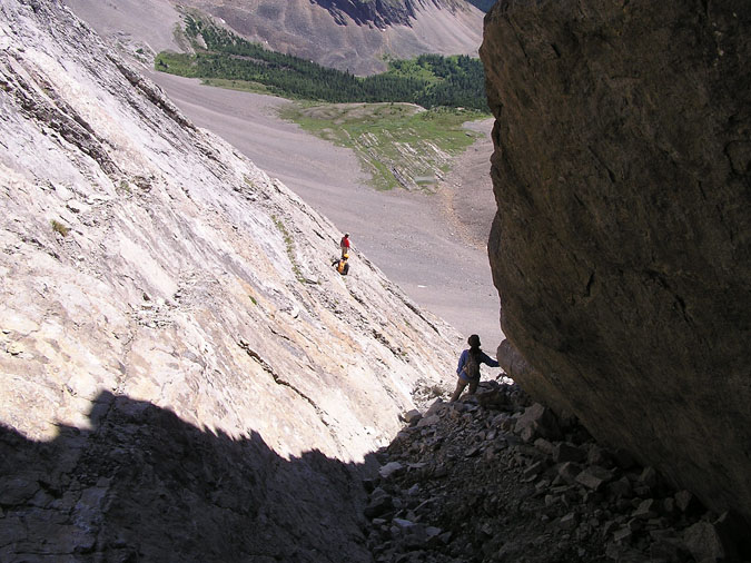
If you look closely, you can see the 2 girls sitting on a rock just below the center of this picture. (Mamiko is wearing the red windbreaker.) We couldn't hear what the girls were talking about but I was sure they were using some nasty Japanese adjectives to describe my routefinding skills. I could tell that they weren't crazy about climbing this peak after our "warm up" but to their credit, they continued to slog upwards. |
 |
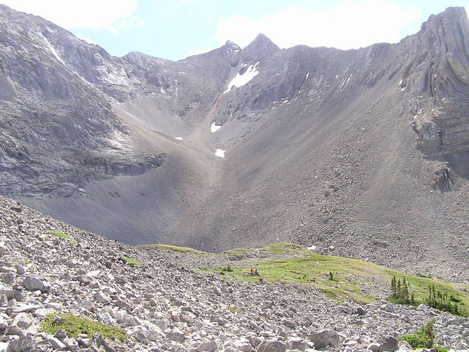
Here's Mamiko as she approaches to within 10m of the ridge. Highway 40 can be seen at the upper edge of this picture. |
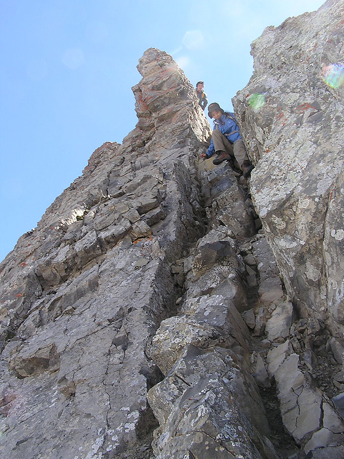 |
Once on the ridge, the scree slog was over - only to be replaced by a narrow exposed ridge which required some fun scrambling. The hardest part of the traverse to the summit was this chimney which was around 10m high. The chimney itself wasn't bad but climbing into it from the ridge was a little time consuming. Click on the image for a full portait sized image. |
 |
A few sections of the summit crest were overhanging and required a bypass on the south side. Click on the image for a full portait sized image. |
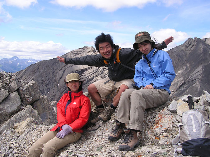 |
After several false summits, we finally made it to the summit of Mt. Arethusa! Unfortunately, there was no register to sign so I decided to take this pic instead. From L to R is Mamiko, Yuji and Kazumi. For the descent, we decided to check out the alternate descent listed in the guidebook. I knew from other trip reports that it wasn't any easier but we figured we'd check it out since it was just below us. |
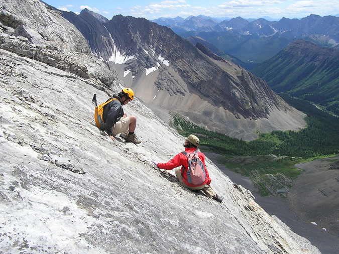 |
After traversing downwards on a few ledges, we made it to within viewing distance of the "notch" described in the guidebook. Below the notch was a gully which made its way to the bottom of the mountain. Getting to the notch however, was a different story altogether because it involved descending a huge angled slab which was very smooth. I spent a few minutes scratching my head when I heard a yelp from above and saw Mamiko sliding uncontrollably down the slab on her rear. Luckily for her, she stopped within a meter of the edge because if she didn't, she'd probably end up at the bottom of the gully in several pieces. Here's Mamiko on the slab as Yuji comes down to comfort her. I decided to do the manly thing and take pictures. |
|
 |
We eventually made it to the notch by slowly inching forward on our butts until we made a controlled slide on the slab to the notch. After making it into the gully, we figured the rest of the descent was a piece of cake. |
|
 |
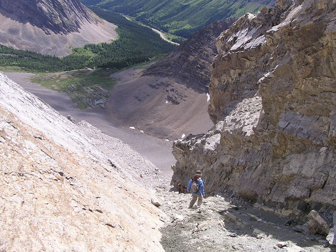
Of course that wasn't the case. Halfway down the gully, we noticed that it was full of snow. The problem with the snow was that it hid the terrain underneath which could be covering a significant drop. We could also hear the sound of fast flowing water so we decided to play it safe by traversing over to the left on narrow ledges. By traversing and descending ledges, we made it to with 100m of the bottom but were stopped by a huge cliff which was at least 10m high. We were now faced with 3 options. Option 1 was to climb back up and find an alternate descent route. Option 2 was to try and downclimb the vertical wall. Option 3 would be to take our chance in the gully. We decided to choose option 3. After carefully traversing back into the gully by sliding down some more slab, we were ecstatic to find some easy (but wet) terrain until we came to a drop in the gully. |
|
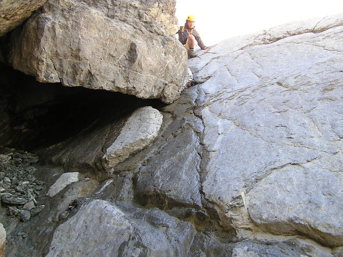 |
Here's the drop. It consisted of a steep smooth wall of about 45 degrees and dropped about 4 or 5m. It wouldn't be too bad if it was completely dry but on this day, it resembled a ride in a theme park. (This picture does a poor job of showing just how much water was flowing down this wall.) If one were to screw this up, he/she would fly down a smooth and narrow gully flowing with water until it ended in a small boulder field. Unfortunately for me, I did screw up and slid about 5m down the gully before I somehow stopped myself. I was still feeling the rush of adrenaline when I heard a scream from above and saw at least 3 rocks about 40cm in diameter come flying down thanks to Mamiko. One of them missed my head by a metre so I decided to crawl back up and take shelter in the cave as I guided the other 3 down the drop. The others were able to climb down thanks to some hidden handholds under the cave ceiling. (Which I noticed only after crawling inside.) |
|
 |
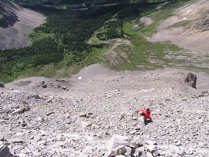
Finally, here we are at the base of the mountain once again. The hike back to the car was quick and eventful but I made damn sure Mamiko was at least 10m behind me. She was definitely cursed this day. |