 |
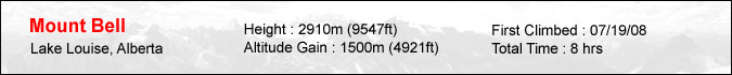
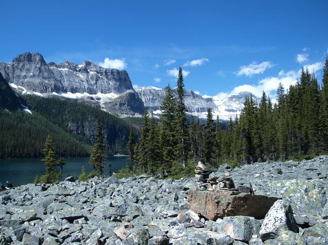
I'm not sure why I decided to scramble Mt. Bell. It was never a priority on my to-do list but it suddenly popped up in my mind when I woke up on Sunday morning. I guess one of the reasons was that I wanted to check out Boom Lake. I skied to the lake several times so I thought it'd be nice to see how it looked during the summer. The other reason was my impression that Mt. Bell was very straightforward and relatively easy to do. Of course if I read the guidebook a little more closely, I would've noticed that it involved 1500m of elevation gain! After leaving Calgary at a leisurely 9am, I arrived at the Boom Lake trailhead at around 10:30am. My regular partners were unavailable this day so this was a solo climb. I knew this peak had an alternate start via Taylor lake I decided to scramble it via Boom Lake for the views. The hike in took about an hour and was uneventful. The view of the lake however, made the hike very worthwhile. |
 |
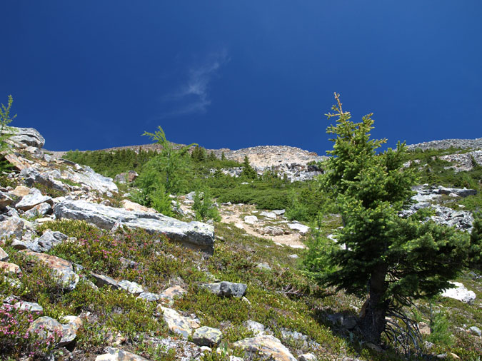
After arriving at the lake, I followed a beaten trail near the shoreline until I arrived at a rockpile which marked ascent gully. Interestingly enough, I came across a few people who were camping along the shoreline. They even had a canoe which they must have dragged in via the trail. I thought about approaching them when I had a sudden flashback from the movie Deliverance which was on Satellite TV a few days prior. I decided to move on and start the ascent. The book called for some bushwhacking to reach the gully but I obviously missed that sentence because I ended up gaining 300m of elevation through thick trees and bushes. It was extremely tiring! |
 |
After noticing the clearance in the trees to my right, I finally entered the gully and made my way up towards the ridge. Here's a look back down the gully. |
 |
And here's a look up towards the ridge. I knew from past reports that almost everyone had made the mistake of gaining too much elevation before reaching the col. Some had even climbed to the ridge above which was completely unnecessary. Keeping that in mind, I did my best to traverse the rocky slopes to the left as I made my way towards the upper ridge of Mt. Bell which was still hidden. |
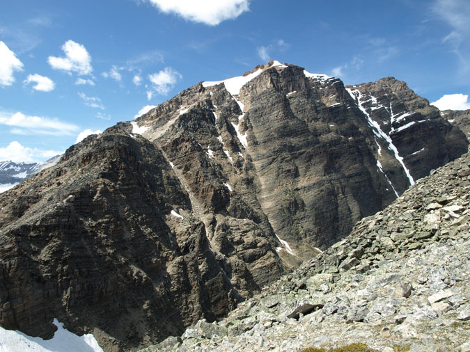 |
Here's my first look of the upper ridge on Mt. Bell. And yes, the col is down to the bottom left. |
 |
Losing that hard earned elevation was not fun but I had no choice. Here's a look down towards the typical terrain along the ridge. The scrambles book shows a line of ascent which completely avoids the ridge (as I later found out) but I decided to follow the crest for most of the way. It provided some interesting scrambling but I also ended up doing some moves I'd never want to repeat on a solo climb. |
 |
Here's one of the many false summits along the ridge. I was feeling really exhausted this day and I felt too lazy to pull out my DSLR. That was unfortunate because it was such a beautiful day. |
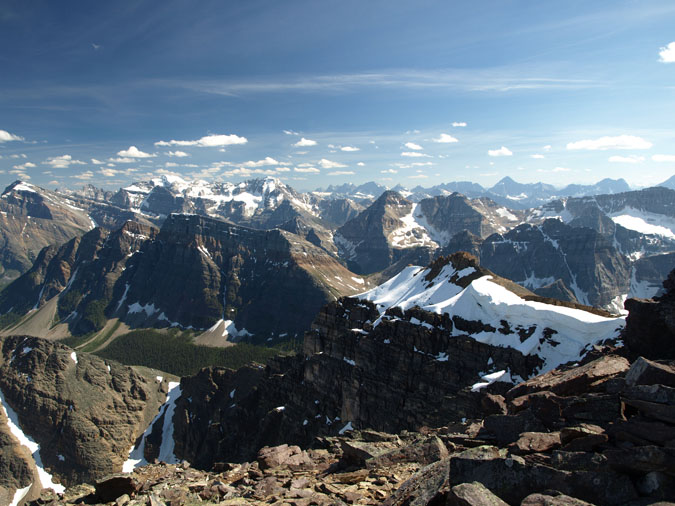 |
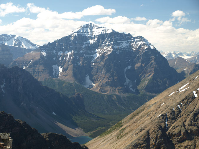
Here's a shot towards the southwest from the summit. As you can see, the view is amongst the best I've seen in the Rockies. |
|
 |
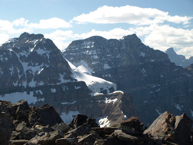
Here's a view towards the south. The big hulking peak which takes up most of the left half is Storm Mountain. If you look slightly to the right of Storm Mountain, you can see the pyramid-shaped Mt. Assiniboine. |
|
 |
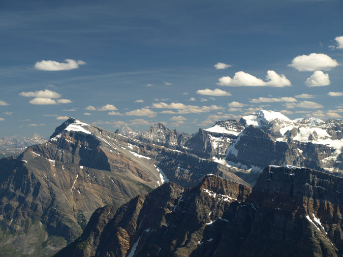
Mt. Temple blocks out most of the view to the north. The scramble route looked to be in shape and to no surprise, I found out that a lot of people were climbing it this day. Due to its sheer elevation of over 3500m, the scrambling season is very short. I'll take my stab in mid August. One of the Consolation lakes can be seen below. The puny little outcrop above is the Tower of Babel. |
|
 |
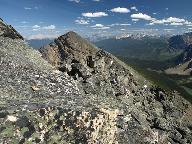
Here's Mt. Quadra to the northwest. The glacier looks impressive when viewed from the north. By the time I was ready to descend, it was already 5pm. I wasn't looking forward to the gully and bushwhack and was almost tempted to descend via Taylor lake but I didn't want to risk waiting endlessly for someone to pick me up as I hitchhiked back towards Hwy 93. |
|
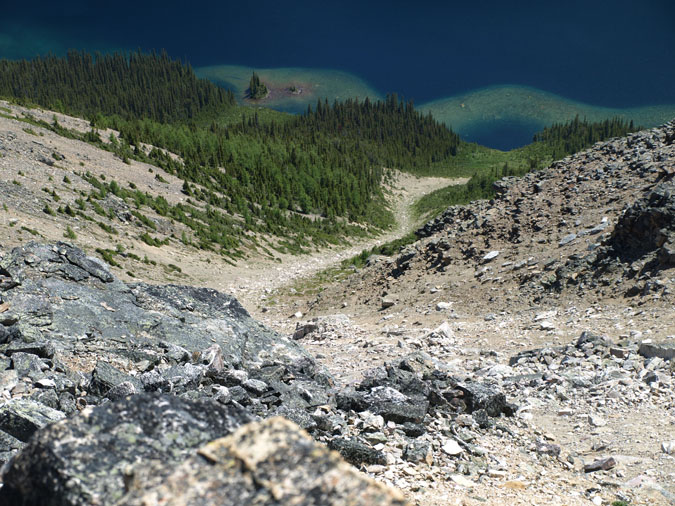 |
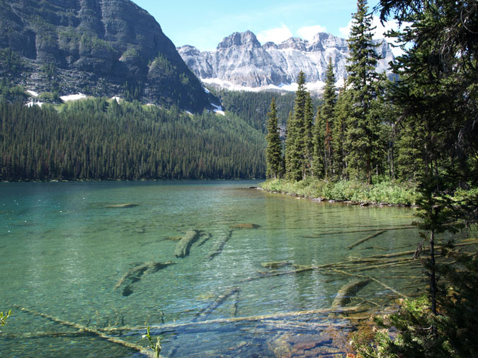
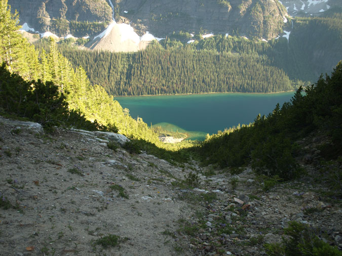
Here's a look down towards Boom Lake from the start of the upper ridge. I took a long look down this inviting gully and was tempted to descend it to the lake. However, I couldn't help but notice how thick the forest had looked from up top. I tried to convince myself that I wasn't the first one to think the same way but I didn't want to risk a 2 or 3km bushwhack. Especially since I was wearing short pants and short sleeves. After staring my traverse to the left, I noticed that my bear spray was missing. I knew I had it during my previous rest stop which was 100m above me but I was feeling way too lazy to retreive it. |
|
 |
After traversing over to my ascent gully, I was able to follow it right down to the rockpile due to my improved vantage point. Doing so reduced the bushwhacking to maybe 30m instead of 300m but the terrain was really steep and hard! If the ground was packed any harder, it'd resemble a rock slab! I reached the bottom of the gully at 8pm and kind of hoped the campers would be there since my water supply of 3L was running low. Unfortunately, they were gone for the day. The final hike to the car was just as excruciating at the final push to the summit. The hike was flat but so damn boring!!! I was half hoping a bear would jump out of the forest to bring out some excitement but that didn't happen. I ended up arriving at my car at 9pm where I collapsed in my drivers seat. What a day! |