|
|
This was a solo climb and it also happened to be one of my last ones for the year.
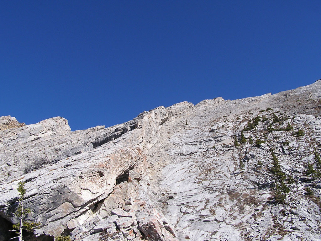
The white patches of snow beside the pinnacles were a definite concern but I decided to chance it anyways. Upon arriving at the parking lot, I met a pair of young guys who were just about to start their ascent when I asked them if they had a good look at the pinnacles. The bearded one of the two looked at me in a confused way and responded that he hadn't as he continued onwards. I found it a little strange but left the trailhead about 10 minutes later.
As I continued towards the ridge, I caught up with the 2 guys who were looking up towards the summit with a look of confusion. I nearly burst into some uncontrollable laughter when one of them asked me, "So... which mountain is this ?". It seemed as though these guys just happened to see a trailhead with a worn out trail and decided to follow it to the end. No wonder they weren't concerned about the pinnacles...
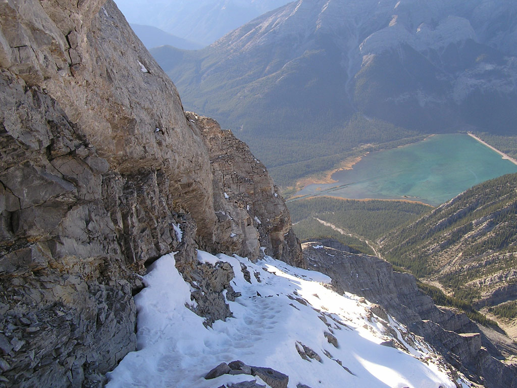
The two routes eventually joined together and led to a steep slope composed of packed scree. A trail composed of switchbacks kept the treadmilling to a minimum and before long, I was at the downclimb. The downclimb consisted of a moderate incline about 8m high which brought me down to the base of the pinnacles. It wasn't difficult at all but only at the bottom was I finally able to check out the snow conditions which led to the summit. As you can see below, the snow wasn't too bad. Both images were taken looking down (obviously). The right one was taken from the summit.
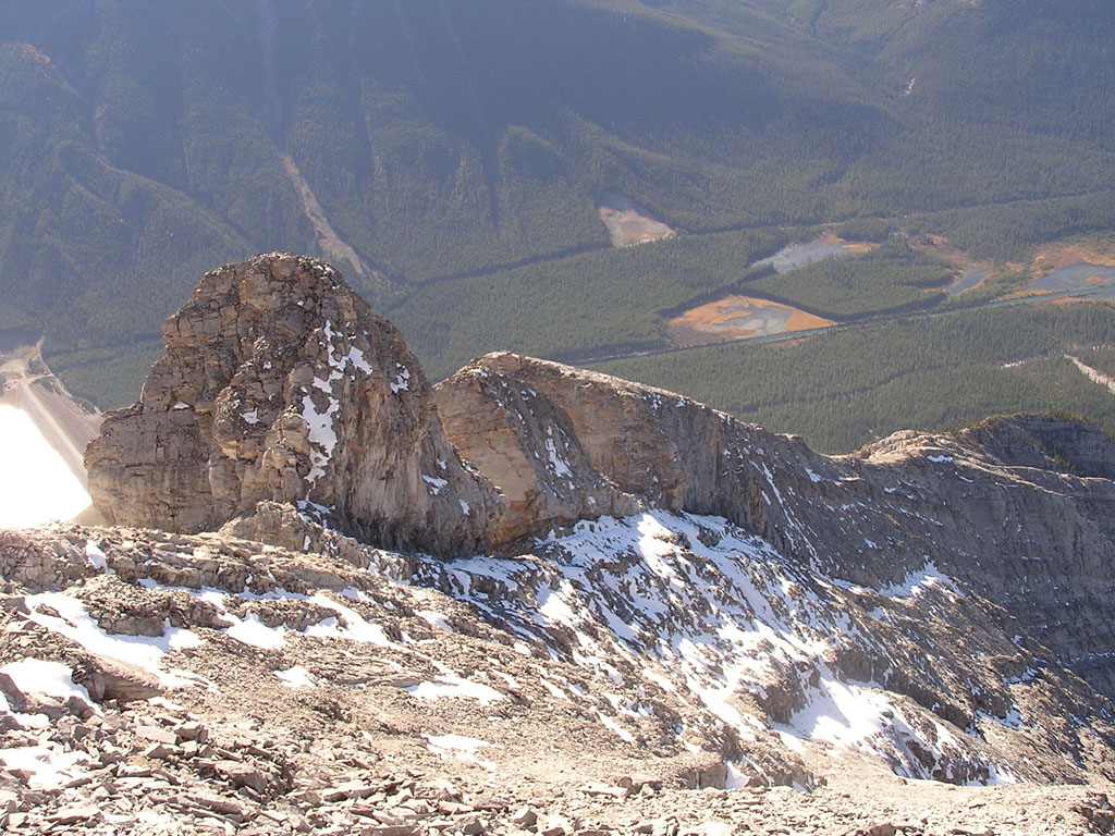
The pinnacle section lasted about 20 minutes as I ascended past 2 sets of pinnacles before reaching the summit about 10 minutes later. The snow was hard packed and slippery at places but I never felt that it was dangerous.
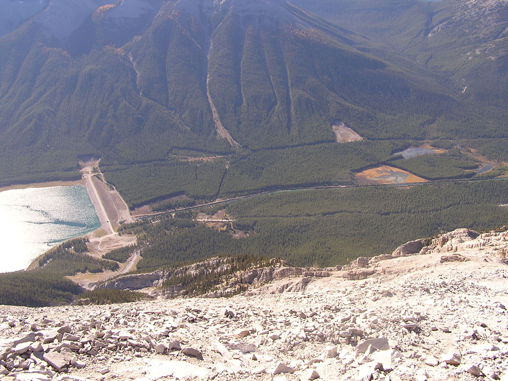
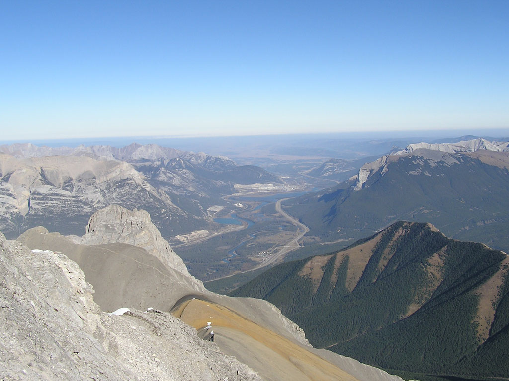
Down below, I found the view down to the middle sister quite interesting since I could see the approach trail which I was on exactly 2 weeks ago to that day. The white line on the bottom left of this image is the trail to the summit of the Middle Sister.
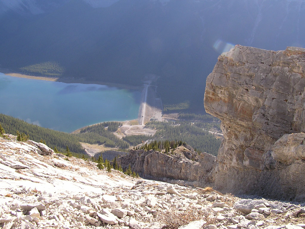
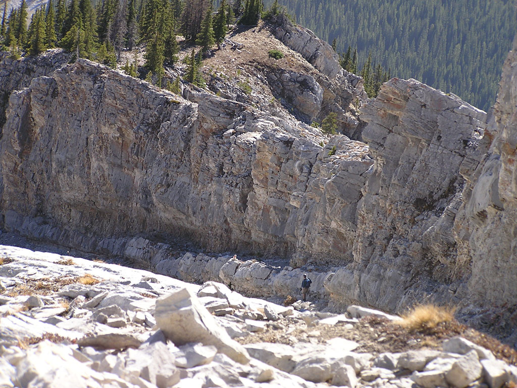
For the descent, I decided to head left at the base of the small scree slope so that I could avoid having to downclimb the slabs. The going was easier thanks to the scree but I was glad I didn't come up that way. After about 30 minutes, I finally arrived at the notch which brought me back onto the ridge. (The one I missed on the way up.) There was a cairn on the bottom but I didn't notice anything up top. The image below on the left is the slope I descended. The image on the right is a zoomed up view of the notch. If you look to the left of the guy in blue, you'll see a small cairn lit up in the sunlight. That's the start of the notch.
After climbing up the notch, I quickly descended to the treeline where I must have taken a wrong turn somewhere. The well worn trail I was on quickly descended into a large gully which eventually turned into a canyon. This wasn't too bad but as I neared the bottom, the terrain consisted of smooth rock which was formed into what seemed like a bobsled run ! The curvature and angle was perfect for a bobsled but it had me very nervous since I didn't know what was down below. I ended up climbing down using friction holds but in retrospect, I probably could have done a bumslide down. But either way, I won't be going back to that canyon ever again. :) |

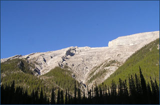 As
the name implies, the Big Sister is the biggest of the "Three Sisters"
overlooking Canmore. Unlike the other two, this one must be climbed from
the back via the Smith Dorian Road. As you can see to the right, you'd
never know that you were passing the big sister if you were driving south
down the road. This peak is rated as a moderate scramble and as Kane says
in his guidebook, it's "downright enjoyable" !
As
the name implies, the Big Sister is the biggest of the "Three Sisters"
overlooking Canmore. Unlike the other two, this one must be climbed from
the back via the Smith Dorian Road. As you can see to the right, you'd
never know that you were passing the big sister if you were driving south
down the road. This peak is rated as a moderate scramble and as Kane says
in his guidebook, it's "downright enjoyable" !