 |
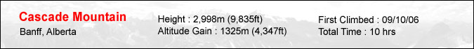
Cascade Mountain is one of those peaks you just have to climb. No, it isn't exactly known for its challenging terrain, serenity, etc. It's just that the mountain is in your face every time you drive into Banff. Just like it's lofty neighbor of Mt. Rundle, it constantly urges you to stand on its summit every time you make that turn towards Canmore on Hwy 1. Seven years of torment was enough... I just had to do something about this pesky little peak ! My partners for this day were Yuji and Megumi. Having some partners for this trip was imperative since the approach was very long and boring. In fact, it stretched for no less than 6.5km along with countless switchbacks before reaching what's known as the ampitheatre... seen to the left. |
 |
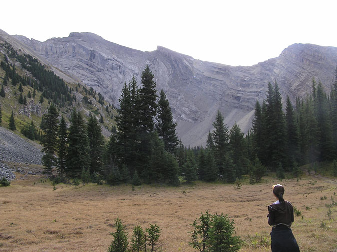
The elevation gain to the ampitheatre is around 500m. Once there, it's another 800m or so to the summit. Thankfully, the views were great once we reached the ampitheatre. Until then, there was absolutely no view except for the ocassional glance of Mt. Norquay through the thick trees. Due to the popularity of the peak, the trails were in excellent shape with almost zero scree. Here's a view of the summit from the start of the ridge. The little marmot was more than happy to pose for this pic. |
 |
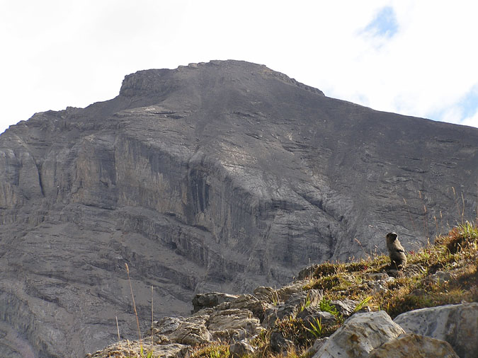
Here's a view of Mt. Louis framed amongst the trees. Mt. Cory along with the 3 peaks of Mt. Edith can also be seen to the left. |
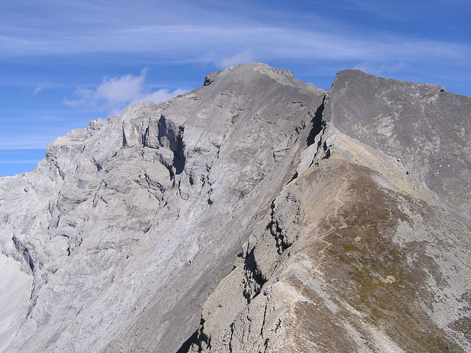 |
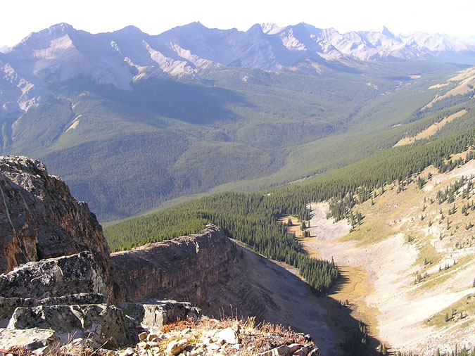
Here's a view of the trail from a grassy highpoint along the ridge. As you can see, a distinct trail leads all the way to the summit. Up until the false summit (which can be seen to the right of the main summit), we decided to stick to the crest of the ridge to avoid wasting any precious elevation gains. This forced us to do some easy scrambling but we noticed that everyone else took the long way around the peak. |
 |
Here's a look back down the ridge. The trail crossed a few boulder fields but they never lasted more than 100m or so. |
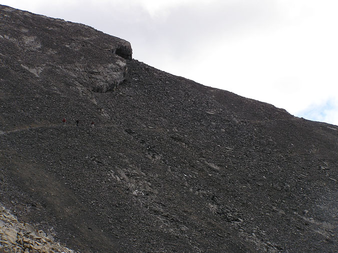 |
Here's a look at the detour (along with 3 scramblers) as it makes its way around the false summit. We decided to take the detour since we didn't feel like scrambling up some loose rock. On the way back, we took a glance at the vertical face required to descend the false summit and agreed that we made the right choice. The downclimb from the false summit to the final summit ridge is definitely do-able due to a prominent crack system but I wouldn't want to do it without having climbed it once. |
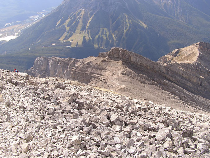 |
Finally, here's a look down at the ridge from the summit. The false summit can be seen in the distance while the slopes of Mt. Norquay can be seen in the background. It's amazing how close the parking lot appears from the summit. |
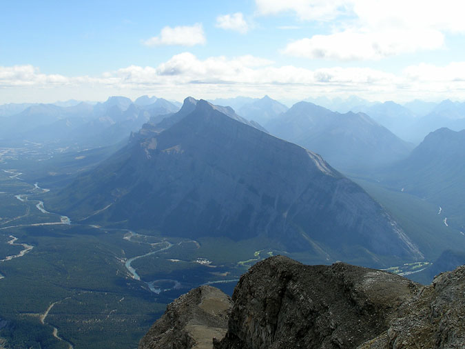 |
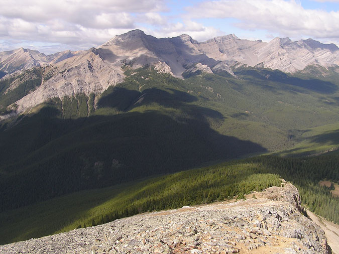
The view from the summit of Cascade was nothing short of stunning. In fact, of the 37 scrambles I've done to date, I'd have to say that the view from this peak is arguably the best of them all. Here's Mt. Rundle - the other massive peak which dominates the skyline from Banff. Rundle is a peak which is very similar in nature to Cascade. It has a very long approach complete with switchbacks, it's very steep but unlike Cascade, it's got a ton of scree for the last 200m or so. So which one is the better scramble ? Cascade by FAR. Cascade has a better trail, has a better view and to top things off, it's slightly higher than Rundle as well. |
|
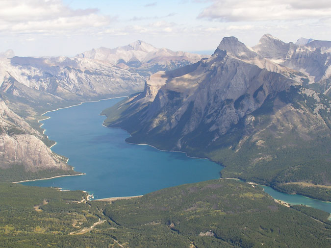 |
Here's one view you won't get from Rundle. Lake Minnewanka is the largest lake in Banff national park and it's simply breathtaking when seen from this summit. Mt. Inglismaldie can be seen on the right/north shore of Minnewanka. I never realized how long the slog is from Johnson lake to that peak. Wow ! |
|
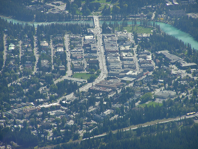 |
Here's a shot of Banff Avenue from the summit. It's only fair that I take this shot since all of the calendars seem to use the shot of this mountain as a backdrop to Banff Avenue. |
|
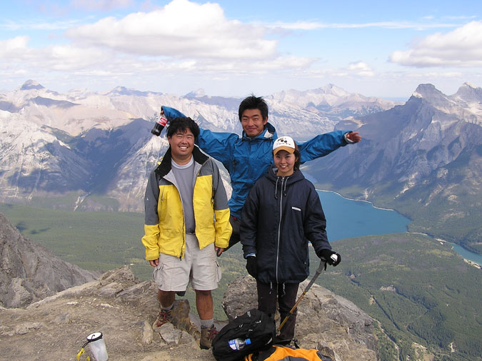 |
Here's a group shot of the 3 of us. The guy who took this picture asked Yuji if he worked for Coca Cola. The ACME summit register can be seen at my bottom left. I'd say it has a few more months before self destructing. The register contained no less than 20 pieces of scrap paper including business cards, cigarette boxes and photocopied pages from the Scrambles guidebook. We signed a piece of paper provided by some other summitteers but I'm pretty sure the Whyte museum will not accept these pieces of scrap in their archives. :) |
|
 |
Here's a view of the ridge crest as it makes its way back to the switchbacks. In case you're wondering, I think we counted 11 switchbacks in total but they were the jumbo sized switchbacks, not the normal kind. Earlier in the day, Yuji decided to throw 3 cans of a certain beverage into 40 Mile creek to keep them cool for the return trip. These cans kept us motivated as we set a blistering pace back to the creek. Upon their consumption, we all agreed that we felt a lot happier... if not a little lightheaded. We didn't even complain about the 3km+ ahead of us (which was mostly uphill) as we laughed our way back to the car. After reaching our car, we drove into Banff for some dinner at the Seoul Korean restaurant. For those of you into Korean food, here's some advice. Spend the extra 15 min and pay a visit to Sorabol in Canmore. It's so much better ! |