 |
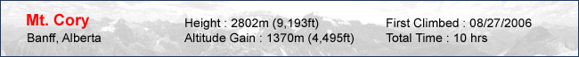
Mt. Cory is a mountain located just minutes away from Banff on the north side of the Trans Canada highway. It's isn't a prominent peak like it's neighbors Cascade, Rundle and Bourgeau but it somehow made itself on my to-do list for 2006. Maybe it had to do with the fact that one of my partners from 2005 told me that it was her favorite scramble. The only thing I knew about this peak was that it was pretty steep and required routefinding to find the proper "rib" to the summit. The routefinding was a little confusing but the trick was to start off on the prominent trail from the road (2km from the 1A exit) and veer off to the right after around 30m. Once we topped the first cliff, we found a fairly well-used trail all the way to the top. My partners for today were Yuji, Momoko, Megumi and Aya. |
 |
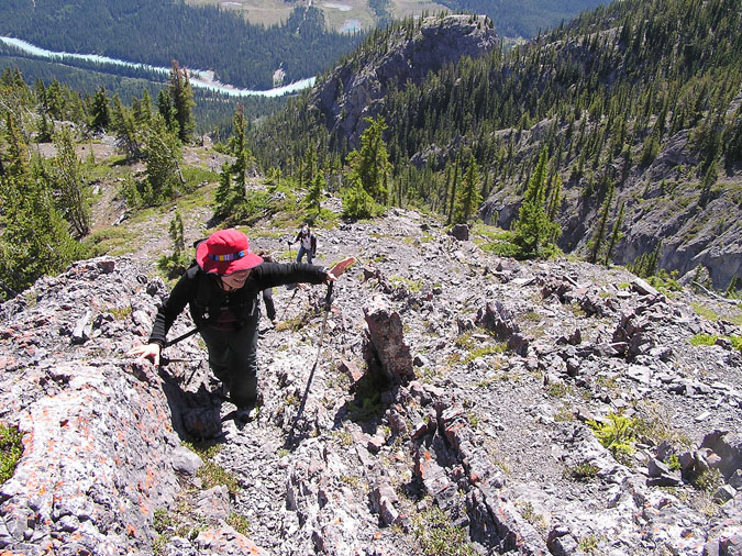
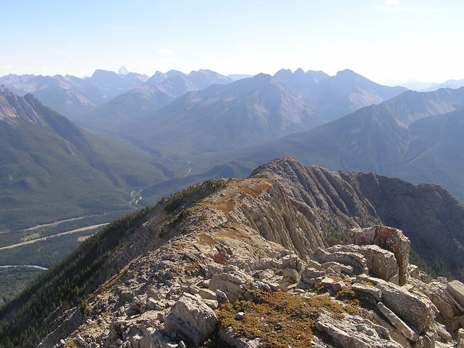
The trail was pretty relentless until it reached a flat point around halfway up. I was a little concerned with our slow pace and late start of 11am but we continued onwards. Two of the girls thought that we had topped out at this point and nearly fainted when I pointed out the real summit. The summit ridge can be seen in the pic. The actual summit is hidden but it's basically ontop of the white section on the left side. |
 |
By the time we reached the top of the hiking section (halfway point ?), it was nearly 3pm. I also realized at this time that I had forgotten my LED flashlight at home since I was using it on my bicycle helmet the previous night. I decided to start up towards the summit while the others took a break. Momoko and Aya decided to wait for us as Yuji and Megumi proceeded to follow me up to the summit. |
 |
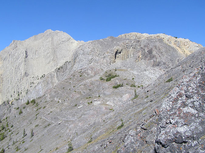
The summit ridge on Cory never seemed to end ! Every time I topped out along the ridge, I'd find another "summit", and another and another ! I kept on glancing backwards to find Yuji and Megumi slowly making their way along the ridge. I'm sure they were thinking the same thing as they continued to see me summit peak after peak. Assiniboine can be seen in the pic to the left. Can you find it ? |
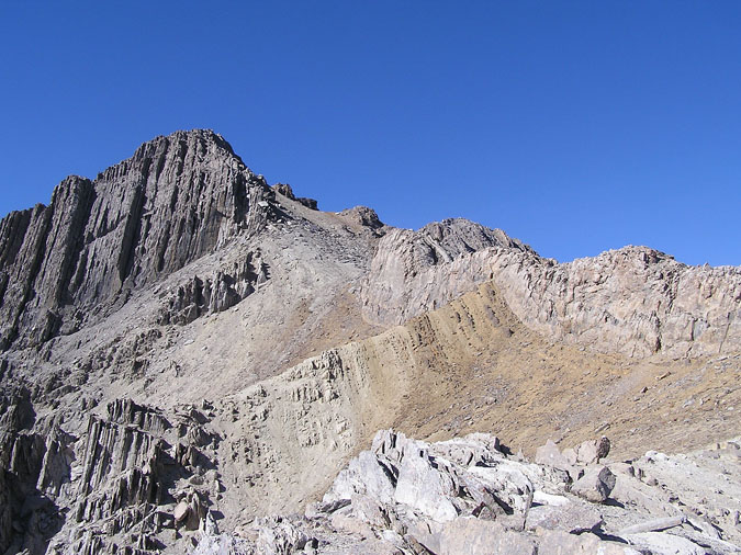 |
Finally, the summit block rears its ugly head ! Well, not really... the summit is out of sight to the right. Time was ticking away as I slowly made my way up the ridge. It was already past 4pm. |
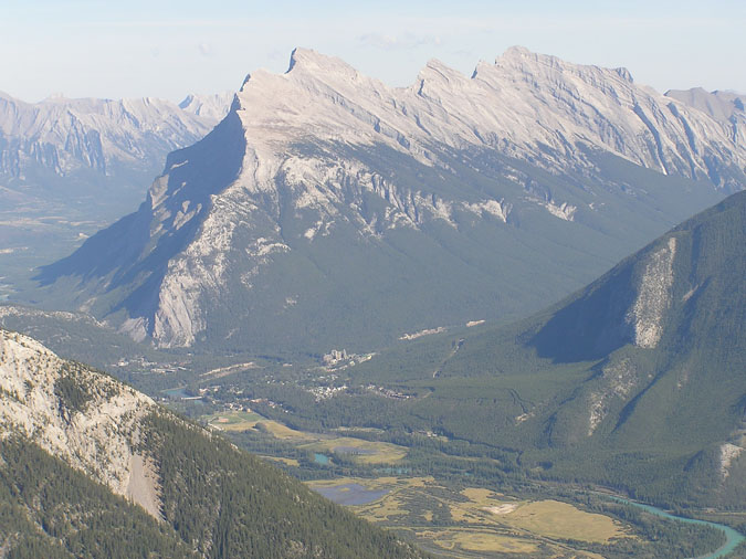 |
Here's a look towards Mt. Rundle from the summit ridge. The Banff Springs hotel can be seen directly below the main summit. |
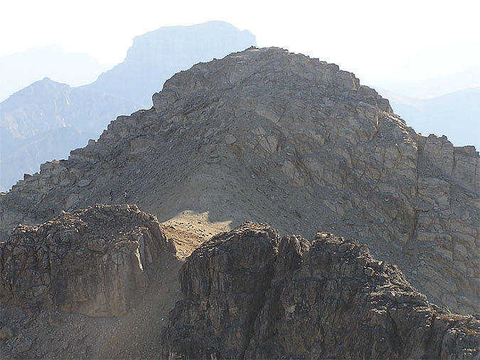 |
By the time I reached the summit, it was around 5pm and in retrospect, I should have started down immediately and perhaps I should have told Yuji and Megumi to return with me. However, after seeing them slowly make their way to the summit, I couldn't find it in me to tell them to turn back after coming so far. So, I just sat down and read through the register which was placed back in 1993. It was so amusing reading all of the entries from the past including an entry from Alan Kane along with many members of the RMB forum. I also found noticed that we were only the 4th group to summit this year. Of course I should have started down instead of waiting for them but by the time I read the register, they were already on the final leg to the summit. Here's Yuji and Megumi approaching the col between the first and main summit. The silhouette of Mt. Bourgeau can be seen in the distance. |
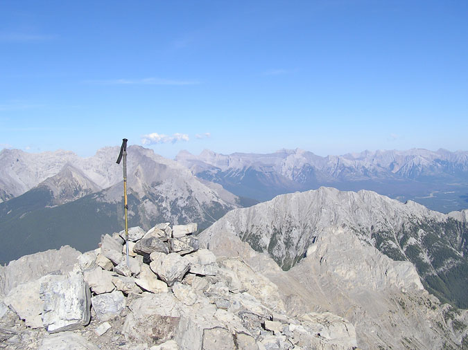 |
Here's a shot of my pole on the summit. The middle and south peak of Mt. Edith can be seeen down below along with Norquay and Cascade. After the other two arrived at the summit, I made it clear that it was imperative that we make the road by nightfall. It was almost 6pm and we had 3 hrs of daylight (at most) so we wasted no time making a hasty descent. Megumi was completely out of water so that only complicated things as Yuji and I were forced to share the little water we had with her. During the descent, Megumi seemed a little fatigued (probably from dehyration) so Yuji went ahead of us to meet up with the other two and start on down. |
|
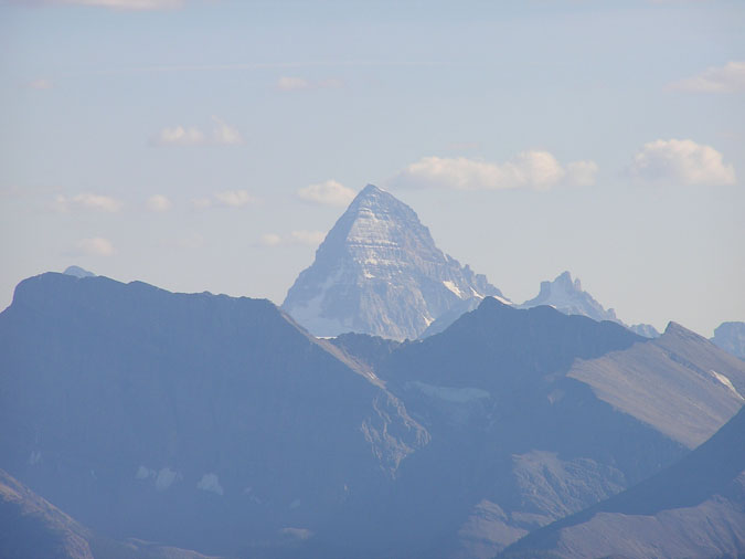 |
Here's a final look at Mt. Assiniboine. This was the last picture I took that day since I was forced to push myself and Megumi to our physical limits to get off the mountain by dark. Yuji eventually met with the girls who were absolutely furious ! They were cold, scared and helpless as we left them waiting for almost 4 hrs. The three of them ended up descending the same trail we used to ascend the mountain. Megumi and I descended the huge scree slope to the left of our ascent route. This option didn't require trailfinding but was very steep. Megumi was behind me and was doing a great job at dislodging rocks onto my back so after the 4th or 5th hit, I suggested that she go ahead first. We eventually made it to the road at 9pm - just minutes before it was pitch dark. Upon reaching the road, Megumi started sobbing - saying something about being happy to be alive but she was so dehydrated that she hardly produced any tears. Now that was weird... |
The case of the forgotten Powerade
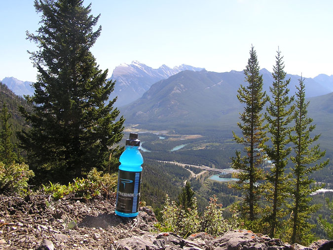 |
Prior to leaving my car, I decided to bring along a bottle of Powerade which I stashed 500m above the trailhead for the way back. I thought it was a good idea since it'd keep me hydrated without having to lug around an extra kg of weight. This was potentially a great choice for the day since at least one of us would have given an arm or a leg for a quick sip. Unfortunately, due to our hasty descent, none of us were able to take advantage of this drink hidden under a fallen log. So what happened to the drink ? Well, after thinking about it for several days, I actually returned 6 days later to bring it back down. If this was a peak like Ha Ling or Baldy, I'd feel content that someone would pick it up. However, due to the unpopularity of this peak, I felt like I was basically littering and felt compelled to return. Here's my Powerade posing for the camera a week later. The label was a little faded but damn ! It sure was tasty ! |