
 |
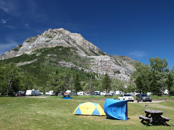
After leaving Calgary at 5am with my friends Yuji, Yuriko and Mai, we quickly made our way to Coutts where Yuriko re-newed her work visa before we made our way to Waterton National park. After setting up our tents in the townsite campground, we spent the rest of the day eating and drinking... which was admittedly our main purpose for driving down. Not only did we have 32 beers for the 4 of us, we also had about 4kg of meat and even brought a Weber BBQ with us. For dinner, we took an offroad trail to the lakeside where we had a picnic table to ourselves as we consumed great amounts of food and alcohol. As you can see by the flipped-over tent, the weather in Waterton was windy as usual. Mount Crandell can be seen in the background. |
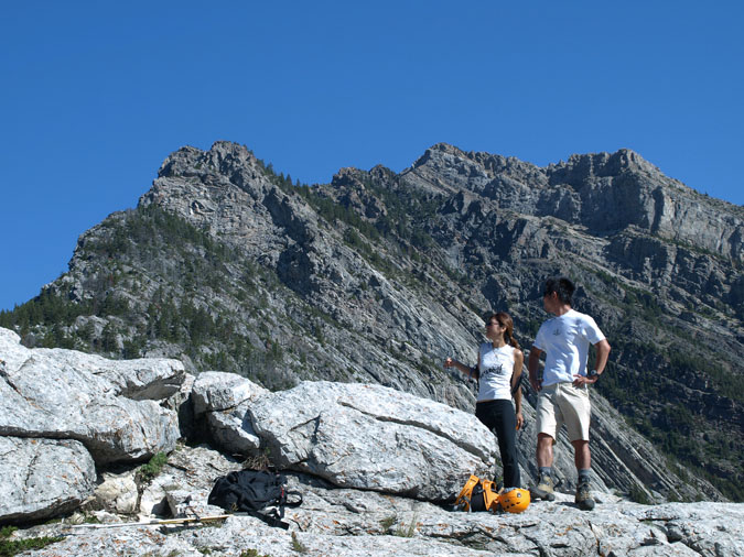 |
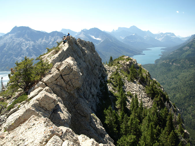
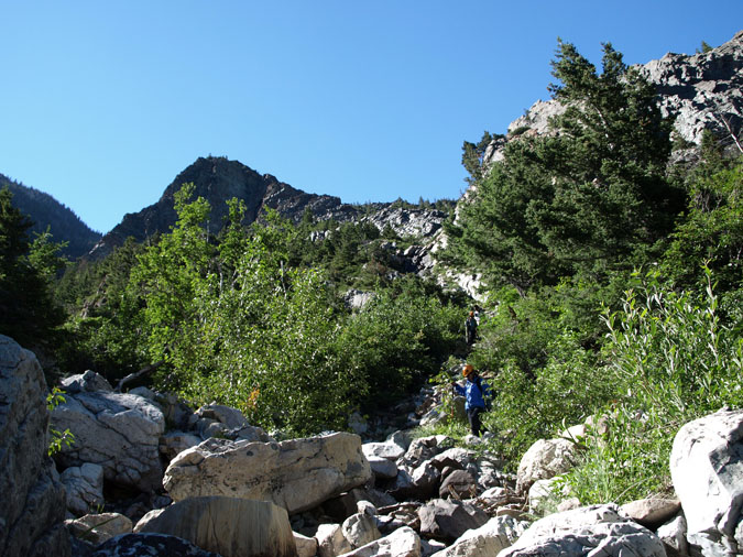
The next morning, we had a huge breakfast and hydrated ourselves with some more beer before heading off from the trailhead. Here's Yuriko and Yuji standing on top of an area called the Bears Hump - a popular destination for hikers. The scramble route can be seen above them. My last visit to Waterton was back in October of 2007 when I tried to scramble Mt. Crandell with a pair of friends. Upon arriving at the park, we noticed a fresh blanket of snow which only got worse when we reached the Bears Hump. We ended up driving back to Calgary which was pretty laughable since we drove 6hrs to hike 45 minutes. This time, the weather was perfect! Not a hint of snow along the ridge and not a cloud in sight! There would be no excuses this time around. |
 |
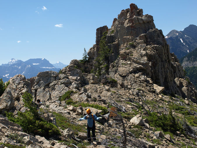
After a quick rest, we quickly made our way up the ridge. One of the things which surprised me was the lack of a trail along with the lack of any cairns. I suppose this is due to the fact that the Bears Hump approach is relatively uncommon on the ascent and almost unheard of for the descent. Here's my group bypassing a tricky section on the ridge by scrambling up "easier" ledges on the climbers left. |
 |
As I was climbing this rock face, I couldn't help but think that it was similar to some of the sport climbs I've done in Kananaskis. It'd probably be rated a 5.3 or 5.4 but it definitely wasn't a scramble. Here's a picture of Mai climbing up the face as Yuji and Yuriko wait their turn. Surprisingly, this was Mai's first scramble ever but she never complained. She later told me that she had serious doubts as she was going up but realized that it'd be harder going down the same way. |
 |
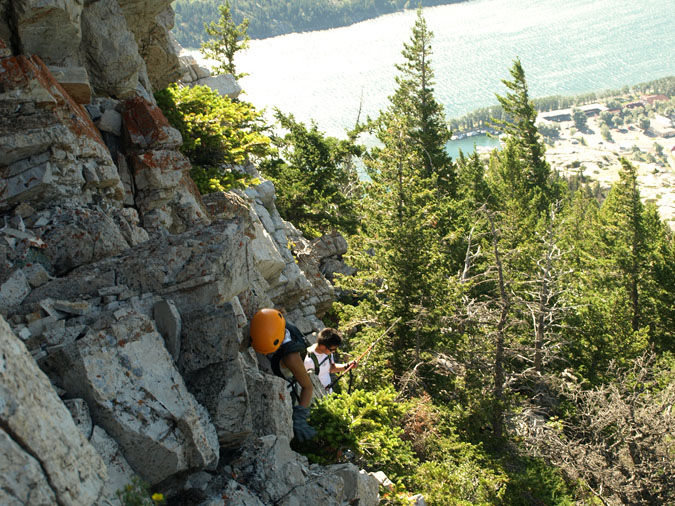
After regaining the narrow ridge, we continued along the crest to avoid the steep scree slopes below. The rock was surprisingly solid. |
 |
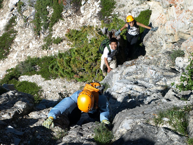
Here we are topping out onto a flat section of the ridge. My partners thought that we were done with the scrambling. Little did they know that the real scramble was about to begin as we climbed onto the cockscomb. As it's name implies, the cockscomb is a series of rocky outcroppings on the crest of the ridge which offers some major hands on scrambling. In fact, it was so hands-on that I didn't even stop to take a picture! Click on the image for a full portrait sized image. |
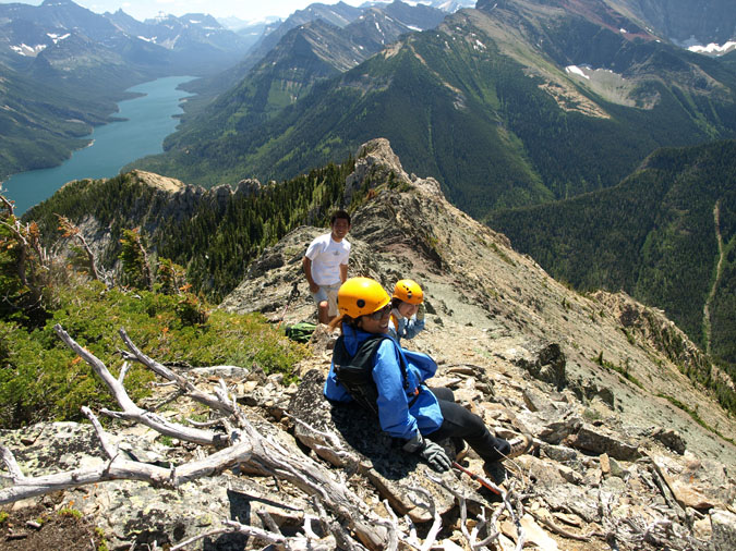 |
Partway through the cockscomb, I decided to bail and stick to the sidesloping grass below since the girls were getting extremely nervous about the rock which seemed to be getting steeper as we went along. Ironically, that's when we realized that we only had maybe 20m of the ridge to go until it flattened out. Here we are taking a rest after finishing the cockscomb. As you see from the rocky outcroppings along the ridge, it involved some serious scrambling. |
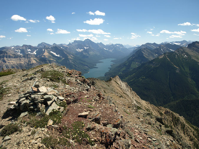 |
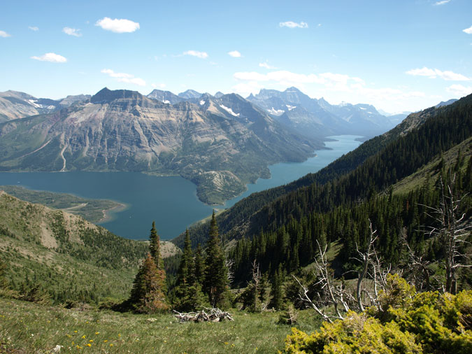
Here's a summit shot of the upper Waterton lake towards the USA. What a lot of trip reports do not mention is the presence of a weather station up top. It was HUGE and even had a helicopter landing pad. What a distraction! |
|
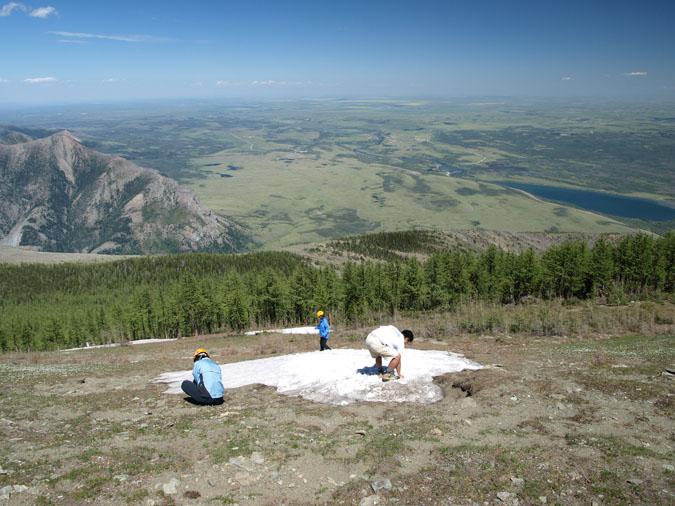 |
Here's Yuji and the girls prepping themselves for a snowball fight. It's amazing how flat it is to the east. |
|
 |
We found the description for the descent to be a little vague but we followed a faint trail into this large gully which eventually led to the road. |
|
 |
Here's Yuriko as she makes it to the bottom of the gully. From here, it was maybe 15 minutes to the road. After looking at the guidebook, we realized that we had descended the gully to the skiers left of Tick Ridge. Perhaps not the route listed in the book but easily do-able nonetheless. Oh yeah, if you're ever in Waterton, make sure you check yourself for ticks. I found at least 3 of them crawling around after I got home. |