|
 Mt.
Engadine is a prominent peak sandwiched between Mt. Buller to the north
and the Tower to the south. It offers a short (but difficult) approach
from the Spray Lakes Road and presents a beautiful unobstructed view of
the Spray Lakes throughout the entire climb. Mt.
Engadine is a prominent peak sandwiched between Mt. Buller to the north
and the Tower to the south. It offers a short (but difficult) approach
from the Spray Lakes Road and presents a beautiful unobstructed view of
the Spray Lakes throughout the entire climb.
My partners
for this day were my friends Momoe and Rie. Momoe had accompanied me on
some scrambles before but this would be her first difficult scramble.
Rie's only scramble to date was Mt. St. Piran. :)
Judging by
the lack of trails and cairns on this peak, Mt. Engadine seemed to be
a mountain which saw very little in terms of ascents... which was a little
strange considering the activity along the Buller Pass trail.
Maybe it
had something to do with what a hiker told me as I was studying the mountain
from the Buller pass trailhead. "You're out of your freakin mind
! Good Luck ! ", said the hiker as she quickly dissapeared into the
forest.
I guess Engadine
did look a little menacing from the road that day. It's steep rockface
and prominent ridge stuck out from the treeline like a sore thumb while
its summit mass was covered in bands of white. I wondered to myself if
I was really out of my freakin mind when my partners urged me to hurry
up.
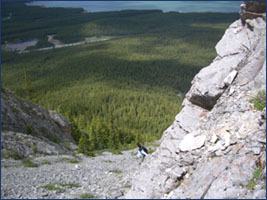 After
hiking the Buller Pass for about 10 minutes, we came across a bridge which
crossed over to the left. Instead of crossing it and gaining unnecessary
elevation, we decided to start the bushwhack from that point by angling
up and to the right. Since we were only able to see the ridge for maybe
10% of the time, I ended up using a compass to find a bearing to the leftmost
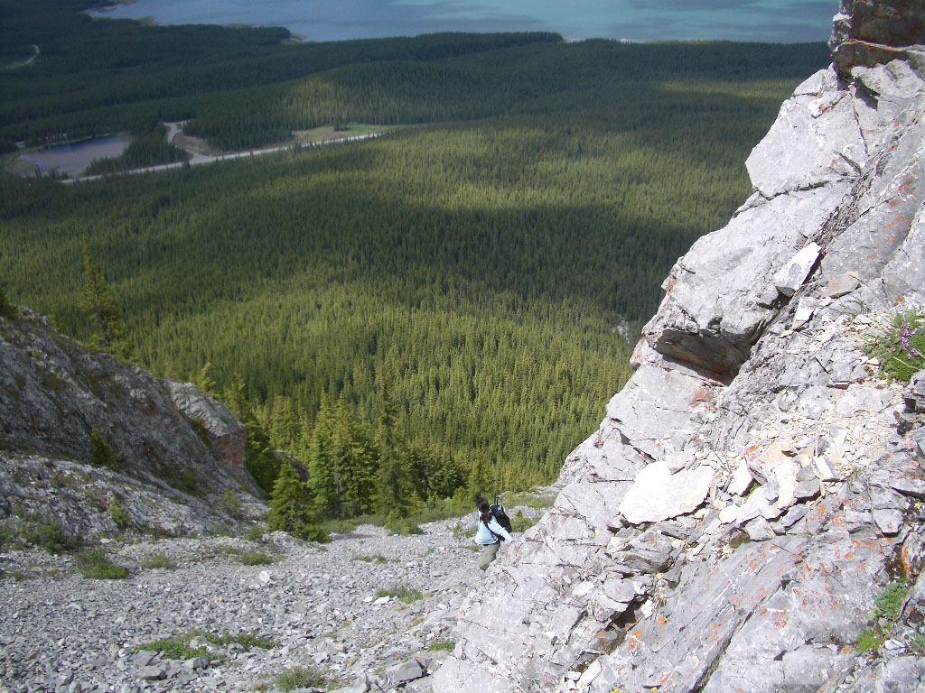
part of the ridge. The image to the left shows you
the ground we covered to get to the base of the ridge. The trailhead is
located near the pond in the upper left corner. After
hiking the Buller Pass for about 10 minutes, we came across a bridge which
crossed over to the left. Instead of crossing it and gaining unnecessary
elevation, we decided to start the bushwhack from that point by angling
up and to the right. Since we were only able to see the ridge for maybe
10% of the time, I ended up using a compass to find a bearing to the leftmost
part of the ridge. The image to the left shows you
the ground we covered to get to the base of the ridge. The trailhead is
located near the pond in the upper left corner.
Upon arriving
at the base of the ridge, we quickly realized that there were no trails
or cairns to guide us to the crest of the ridge - a true testament to
the few freakin people who scramble up this peak. I ended up picking what
I thought was a weakness in the rockbands as I scrambled up to the proper
ridge. The line I took was obviously off-route since it involved some
5th class moves. Momoe and Rie were probably wondering if they bit off
more than they could chew but I assured them that we'd take a different
route down. Well, the proper one at least.
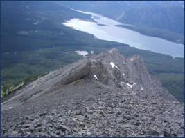
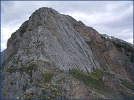 The
scramble up the ridge never felt dangerous but was definitely sustained.
Some sections of the ridge were a little exposed but there always seemed
to be a detour to the left or right which gave gave way to an easier section
which bypassed these exposed areas. The only section which had to be bypassed
without question was the the very last overhang which signaled the start
of the scree. As a safety precaution, I did bring along some rock pro,
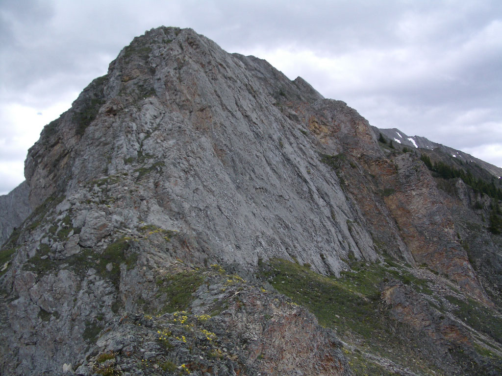
a half rope and some harnesses but I never had to use them. As
you can see to the left, the ridge isn't too steep or too narrow - at
least near the start. The
scramble up the ridge never felt dangerous but was definitely sustained.
Some sections of the ridge were a little exposed but there always seemed
to be a detour to the left or right which gave gave way to an easier section
which bypassed these exposed areas. The only section which had to be bypassed
without question was the the very last overhang which signaled the start
of the scree. As a safety precaution, I did bring along some rock pro,
a half rope and some harnesses but I never had to use them. As
you can see to the left, the ridge isn't too steep or too narrow - at
least near the start.
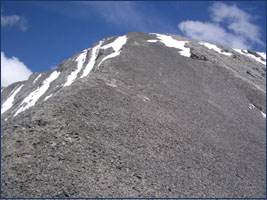 Unlike
some mountains which force you to slog up endless amounts of scree for
a few minutes of scrambling, Engadine forces you to do the exact opposite.
The last 200m of elevation gain was done on a scree slope which (like
all scree slopes) was a pain in the ass. Fortunately, the right side of
the slope had some slabs which made the progress a little easier. Unlike
some mountains which force you to slog up endless amounts of scree for
a few minutes of scrambling, Engadine forces you to do the exact opposite.
The last 200m of elevation gain was done on a scree slope which (like
all scree slopes) was a pain in the ass. Fortunately, the right side of
the slope had some slabs which made the progress a little easier.
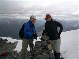
Once at the
top, it was a simple 5 minute ridge walk to the cairn - which had no summit
register ! We spent a total of maybe 1 minute at the top before heading
back down.
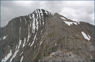
Momoe
(in the blue) and Rie stand on the summit of Engadine. The image to the
right shows the ridge which we ascended. If you look carefully, you can
see me standing near the overhang.
For the return,
we decided to descend to the forest using one of the gullies instead of
downclimbing the ridge. The Spray River road looked very far from the
ridge but the thing which sealed our decision was the wind. The wind was
very strong that day and nearly picked me on at least one ocassion. It
also made any conversation nearly impossible.
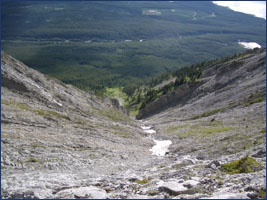 We
started by descending the main gully which was basically an extension
of the final scree slope we ascended. The gully wasn't too steep but we
soon noticed that there was a waterfall at the end. Although we couldn't
see if it was just a simple rockstep or an actual waterfall, we decided
to play it safe as we traversed to the next gully over. The second gully
was a little too steep for our liking so we eventually traversed and descended
the third. We
started by descending the main gully which was basically an extension
of the final scree slope we ascended. The gully wasn't too steep but we
soon noticed that there was a waterfall at the end. Although we couldn't
see if it was just a simple rockstep or an actual waterfall, we decided
to play it safe as we traversed to the next gully over. The second gully
was a little too steep for our liking so we eventually traversed and descended
the third.
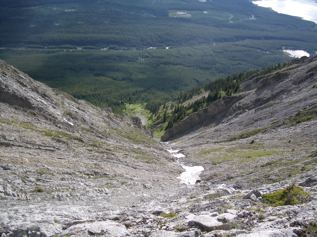
The image to the left is that of the main gully.
Once we reached
the treeline, I used my compass once more to set a direct bearing to the
Spray River road as we started our final bushwhack. Surprisingly enough,
the bushwhack wasn't bad at all. The trees were spread out evenly and
the moss-like surface gave our knees an excellent cushion for the descent.
We all let out a sigh of relief when we came to the Spray River road.
A quick 10 minute walk led us to our car which promptly took us to the
Grizzly Paw in Canmore where we celebrated our difficult scramble with
a Buffalo Burger. :)
|