 |
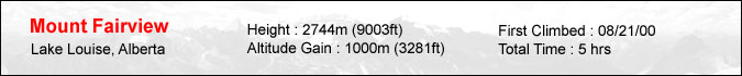
Mount Fairview is perhaps one of the most (partially) photographed mountains in the world. After all, anyone who's taken a picture of Lake Louise has unknowingly taken a picture of the western end of this mountain as it fills in the left edge of the frame. As its name implies, Mount Fairview rewards the scrambler with a great view of the area including the Victoria Glacier and the impressive North Face of Mt. Temple. As an added bonus, the peak can easily be done in 5 hrs via a well marked trail. It's no surprise the trail and summit resembled Ha Ling with it's multitude of people. Although I've done this peak back in 2000, I decided to do it again since my friend Kyoko was visiting for the weekend. She was in great shape but only had a pair of sneakers which limited our options. My other choices were either too simple (Mt. St. Piran/Beehives) or required better footwear (Tower of Babel). Here's a photograph of the backside of the mountain from the "Saddle" which is reached in appx. 1 hr from the trailhead. |
 |
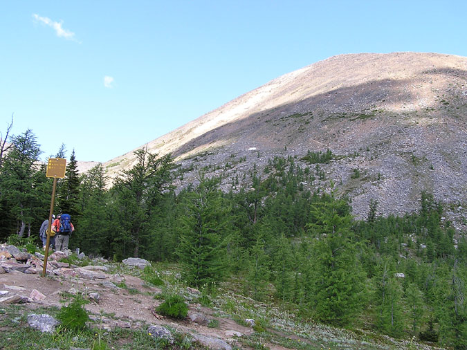
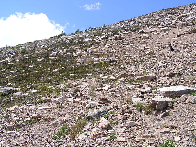
The trail from the "Saddle" is well worn all the way to the summit and includes a countless number of switchbacks. Here's a look back towards the "Saddle" which is located in the right-center part of the picture. The peak in the center is Saddle Peak which (judging by the lack of a cairn or trail) is pretty much neglected. The east ridge of temple can be seen in the far distance. |
 |
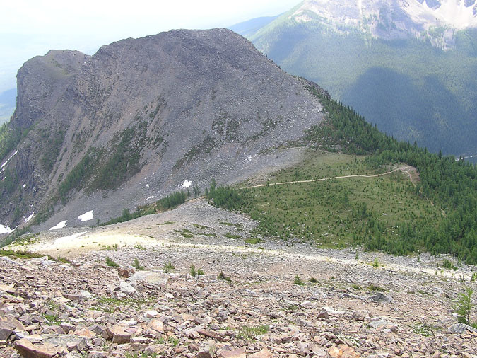
Here's a picture of Kyoko taking a short rest on the trail. Poor Girl ! She thought her tour would consist of pleasant walks, exquisite dinners and hot springs. Instead, I took her mountain biking two hours upon her arrival at Calgary International where we hit 20km of singletrack in Kananaskis while being poured on. The next day, we hiked up Fairview only to do another 20km of mountain biking on Monday. Ah well... her exquisite dinners were downgraded to granola bars but otherwise, she did manage to do some walking (uphill with a bike) and did manage to get soaked from head to toe with a mud bath thrown in for good measure.
|
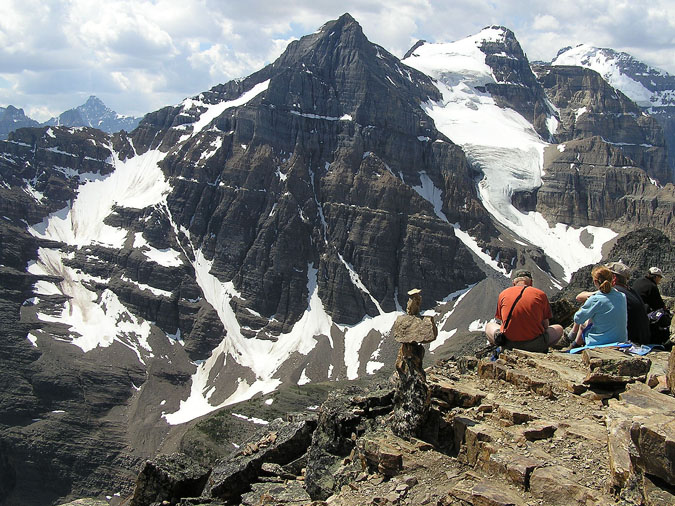 |
After about 2.5hrs of hiking, we finally reached the summit where we were greeted with excellent views all around. Upon reaching the top, I gave Kyoko a healthy slap on the back to congratulate her efforts to which she screamed out loud at the top of her lungs. Apparently she was afraid of heights... Anyways, here's a view towards Aberdeen & Haddo. That glacier sure looks enticing ! |
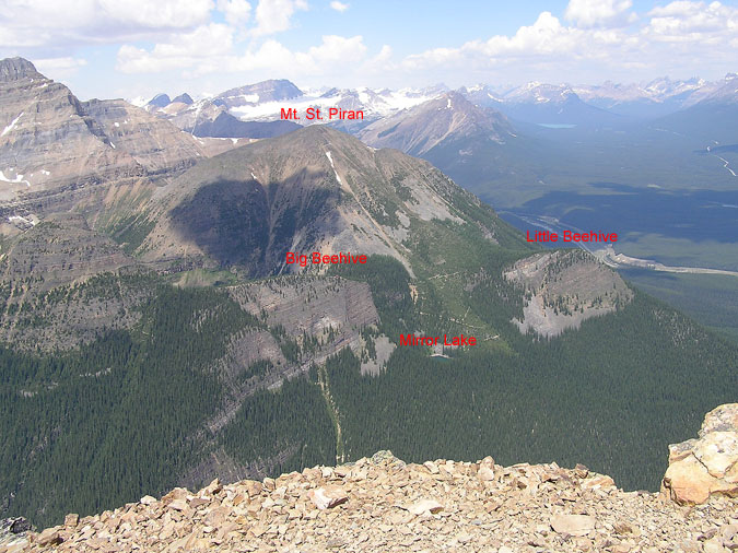 |
Here's a view to the north from the summit. When viewed close up, it seemed to resemble an ant farm with tiny specs of people walking all over a system of trails. Looking over the edge gave you a view of Lake Louise but it was mostly obstructed by the cliffs down below. |
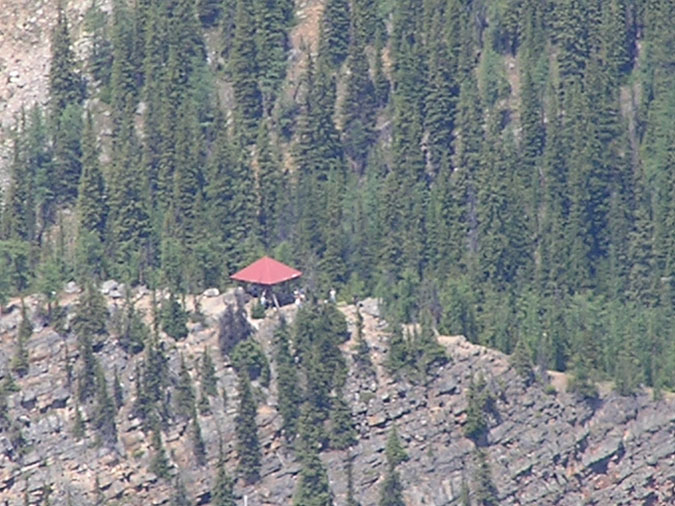 |
Here's a 30x shot of the gazebo ontop of the Big Beehive from the summit. As usual, it looks to be crammed with tourists. |
 |
After resting for appx. 30 minutes at the summit, we finally made our way down. Somewhere along the descent, I took a detour which angled its way towards the main trail - thus bypassing the longer traverse towards the "Saddle". This saved quite a bit of distance at the expense of being a lot steeper. I didn't mind it too much and hoped that Kyoko wouldn't notice the difference... but she amazingly did. |
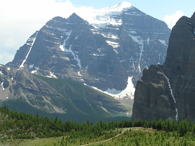 |
Finally, here's a great view of the north face of Mt. Temple with Mt. Sheol to the right. The "Saddle" can be seen just below Lake Annette. I tried to explain to Kyoko that we wouldn't have been able to see that beautiful lake if we kept to the original trail. Luckily she was too exhausted to disagree with me and just nodded her head yes.
|