
 |
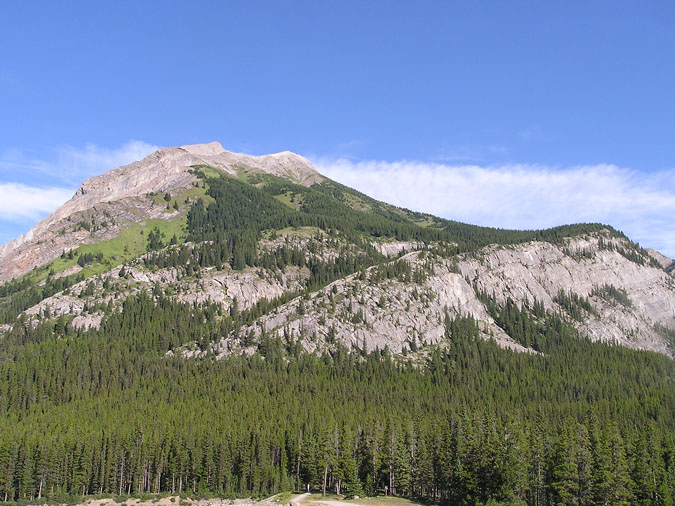
Mt. Indefatigable is another one of those mountains which has been on my "to do" list for some time. After all, not only does it offer a pleasant ridge walk but the views of the lake were supposed to be spectacular. I actually tried this peak back in the fall of 2004 but was turned around at the parking lot due to a bear warning. This time, I made sure in advance that there were no trail closures at the lake. The day didn't start off too well. After leaving Calgary at 7am, I realized 30 min later that I forgot my damn socks ! I've forgotten my boots, helmet and poles before but never my socks ! I ended up driving back to Calgary to find them on my stairs. Here's a view of the peak from the parking lot. |
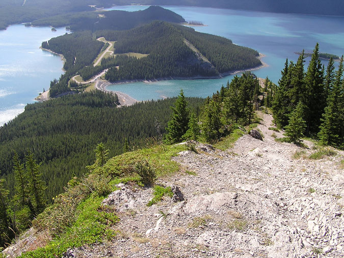 |
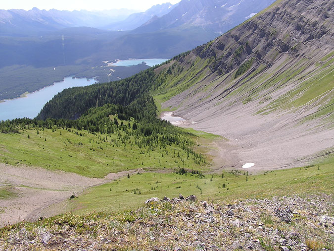
The 90 minute drive to the Lakes was quite frustrating due to my stupid mistake but after seeing the lakes and the surrounding area, I found myself feeling really energized and ready to go ! In fact, I was so pumped up that I ended up missing the (unsigned) trailhead and hiking 3km around the lake before realizing my mistake. Way to go champ ! I was really glad that this was a solo climb 'cause anyone who joined me would probably be doing so for the last time. :) After retracing my path to within 5min of my car, I took the official trail which quickly made its way up past the treeline. The going was fairly steep but the beautiful views were a great distraction to the physical exertion. Here's a look back at the trail. The parking lot can be seen at the upper left. |
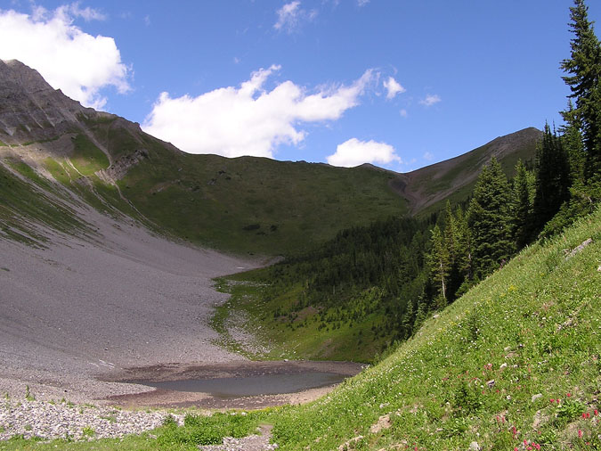 |
After passing the first turn off for the south summit, I continued up the ridge towards the north summit. It should be noted that there are no benches as indiciated in the guidebook... and no signs either. The trail towards the north summit is considerably longer but gains elevation at a moderate rate on packed terrain. In retrospect, the trail to the south summit was very steep and involved countless switchbacks on loose terrain. I was really glad I went north to south. Here's a small tarn between myself and the col which leads to the north summit on the left. |
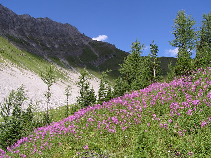 |
Here's another view of the trail as it makes its way upwards. It's a pity that so many people ignore this part of the mountain and go solely for the south summit. It isn't even the real summit !!! :) The guidebook suggests going through the grass and making a beeline towards the base of the ridge. I decided to take the longer indirect route because of the trail and flowery meadows. |
 |
Here's a look back at the tarn from the col. The steep ridge towards the south summit can be seen rising from the center of this picture. |
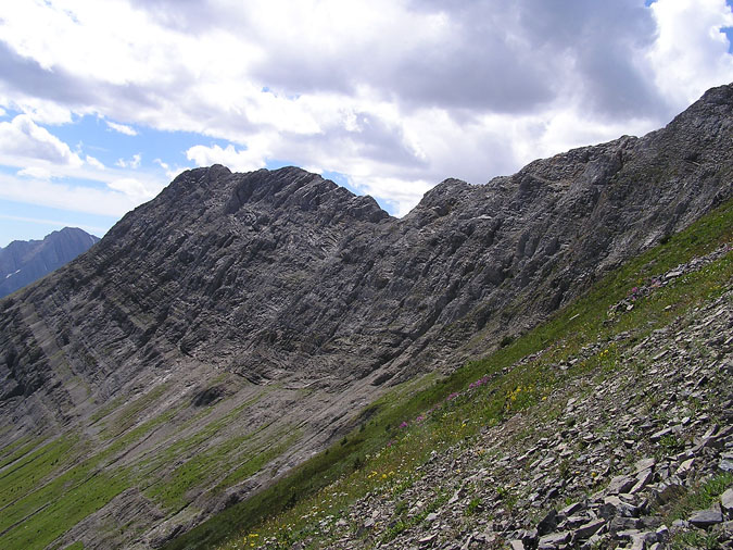 |
Here's a look towards the south summit from the col. |
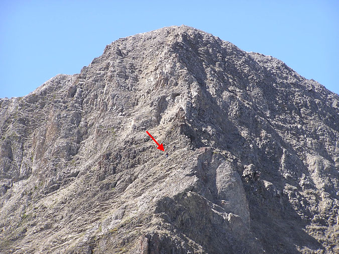 |
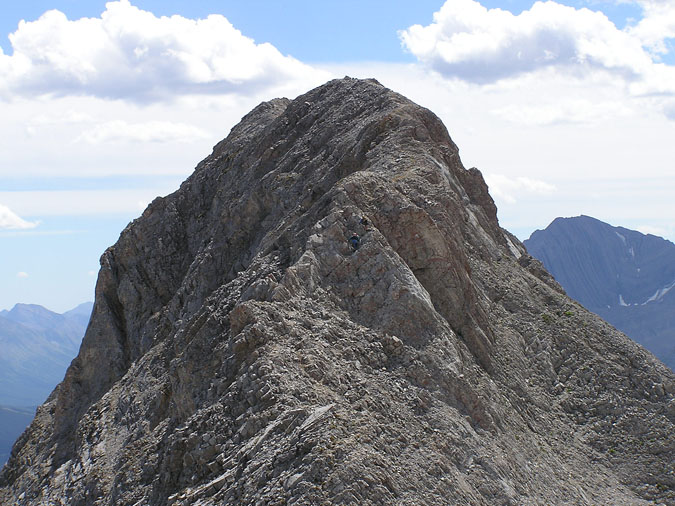
Finally, it was time for the scrambling to begin ! From a distance, the north summit seemed a little imposing but it wasn't bad at all. A well used trail made its way up the face while avoiding any sort of major exposure. Some sections of the trail looked a little loose but never dangerous. Either way, I decided to make this section interesting and take a direct line up the ridge to the summit. The rock was suprisingly solid and the scrambling was downright enjoyable ! My only regret was that it ended so soon. The red arrow is pointing to one of two scramblers who were ahead of me. |
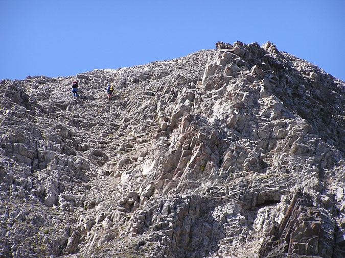 |
Here's a zoomed up shot of the north summit. The two scramblers ahead of me are within seconds of the summit. They decided to ascend straight up a gully (which looks much steeper in the picture due to the zoom). Of course I chose to stick to the right side and ascend the ridge. |
|
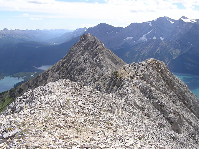 |
Here's a look towards the south summit from the north. As Kane mentioned, this was mostly a hike with maybe 2 sections where I had to use my hands. |
|
 |
Here's one of those sections. The two scramblers can be seen at the center of the pic. After catching up with them, I realized that they were the two individuals at the parking lot who were putting on their boots as I left. One of them said, "There you are ! We were wondering where you were." I responded by telling them that I went for a warm-up hike before returning for this peak. |
|
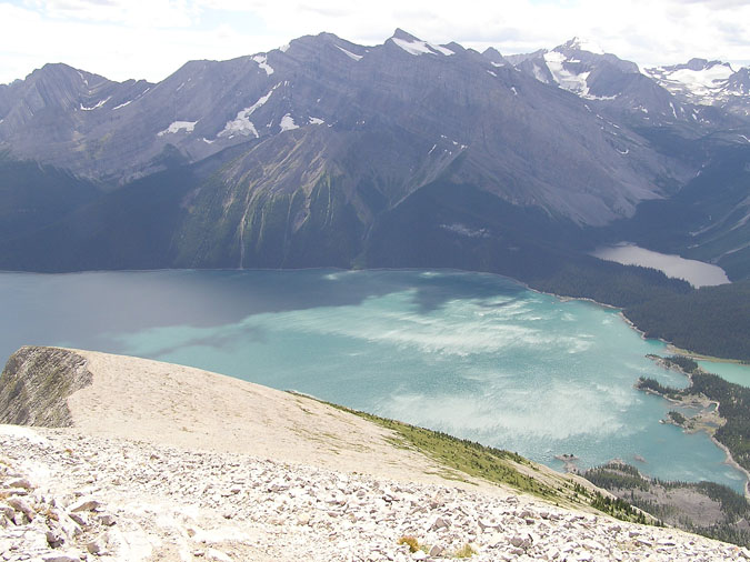 |
Here's a view of the lakes from the south summit. Some scientific equipment consisting of solar cells, antennas, etc. cluttered the summit but the views of the lake and beyond made the traverse worthwhile. In case you're wondering, the white sections of the lake are actually ripples / waves. The wind was very strong this day. |
|
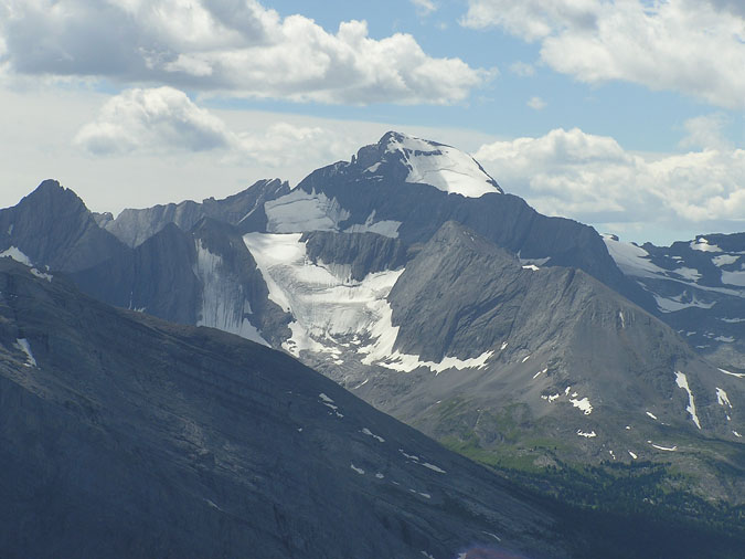 |
Finally, here's a view of Mt. Joffre from the summit. I'll have to give that a try someday. The descent from the south summit was fairly uneventful but again, the trail was considerably steeper and loose compared to the north summit. In summary, this peak was definitely worth the hassles I had to deal with in the morning. It's one of the few scrambles which I wouldn't mind doing once more. |