 |
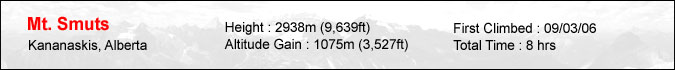
Mount Smuts. The mere mention of this peak is enough to make a serious scrambler weak in the knees. After all, this peak is debatably the most difficult scramble in the guidebook. I've always had a fascination with this peak since the day I bought my scrambles book back in 1999. Seven years and 34 scrambles later, I decided that it was time to put my skills to the test. Just in case I'd bite off more than I could chew, I asked my friend Makoto to accompany me on this trip. After picking him up in Canmore at 7:30am, we started off on our mountain bikes at 8:30am. The trail to Commonwealth creek is only 2 or 3km long but it can seem like 10km on the way back - as I found out when doing the Fist. Here's Mt. Birdwood as seen in the reflection of Commonwealth creek. |
 |
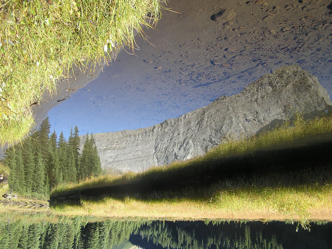
The first step to climbing Mt. Smuts is to gain Smuts Pass. The good news is that the trail is in great shape all the way to the pass. The bad news is that there's practically no elevation gain from the parking lot to the base of the pass. That means all the climbing is done within the last 1000m or so. Luckily the pass isn't too high. Here's a view of the Fist from the trail. |
 |
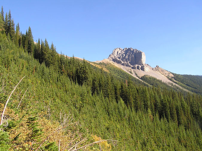
Here's a view of Mt. Smuts from the trail. The scree cone/ascent route can be seen in the distance. I was really lucky that I was able to convince Makoto to join me this day. Makoto works as a hiking guide/porter for Yamnuska and during his days off, he's usually hanging off some ridiculous slab of rock as he prepares for his ACMG assistant rock guide certification. In true guide fashion, he packed a 50m rope along with some rock pro and never once complained about his extra burden. He was also quick to point out any wildflower or edible plant we came across - thus enriching the experience. I knew he had zero interest in scrambling but luckily for me, he made an exception for Mt. Smuts since he heard some good things about it. (Good = good challenge.) |
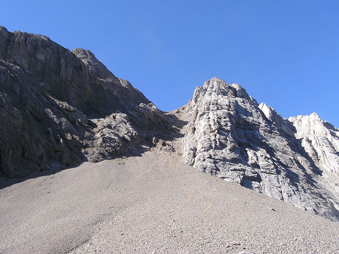 |
Here's the scree cone/ascent route for Mt. Smuts. The route basically follows the right hand side of the gully all the way to the top. Once the gully runs out, the real scrambling begins as you climb the right hand wall to the ridge. |
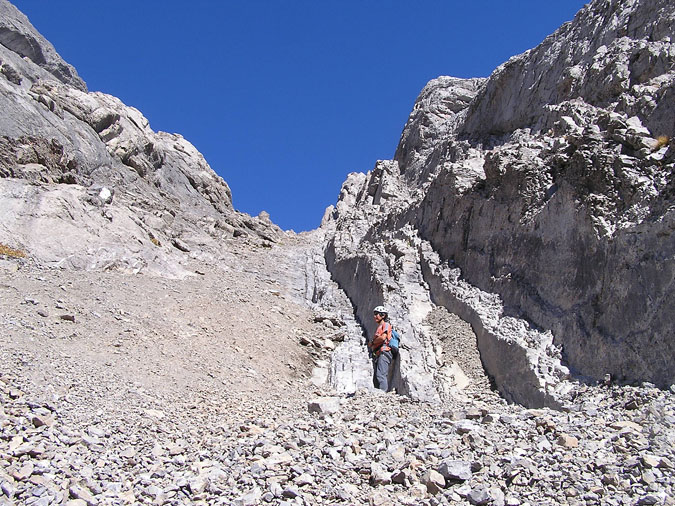 |
After putting on our helmets and harnesses, it was time to begin. Here's Makoto at the base of what he called the "escalator". The "escalator" is a lot steeper than it looks in this pic but it was pretty fun. The footing was great and there was always a "handrail" to grab onto when it got really steep. |
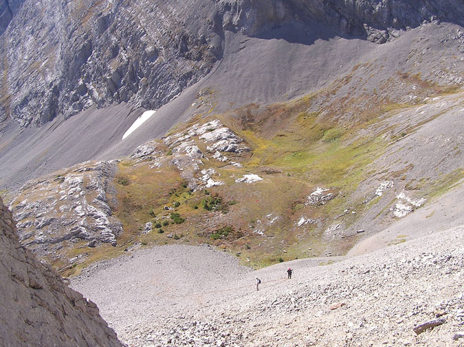 |
Here's a look down towards the base of the scree cone. We ran into the 2 scramblers below while we were gearing up for the climb. They were 2 guys in their early 20's and although they both had boots and a helmet, they seemed to be a little unsure about the mountain. One of them kept on glancing at the ascent route with the scrambles book in hand while the other guy kept on asking me if I knew some guy named Dave who was into climbing and had an extensive website. I told the kid that I had sushi with him the previous week ... and then started up. |
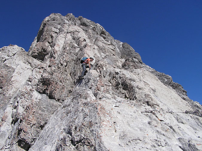 |
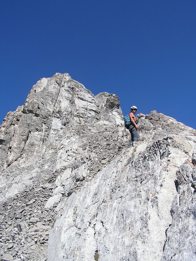
After around 30 min, the "escalator" eventually ended - leaving us with no choice but to ascend the wall to the right. Makoto mentioned something about an "elevator" before moving onwards. The kids below made it pretty obvious that they were following in our footsteps but their voices became fainter as the terrain became steeper... never to be heard again. Of course we made sure their car was gone from the parking lot upon our return. Here's Makoto starting up the ridge. |
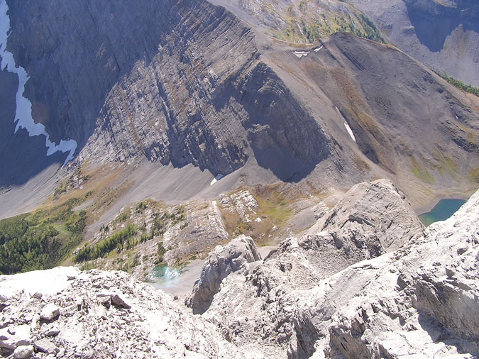 |
Here's a look down the ridge. One of the Birdwood lakes can be seen to the right of our ridge while the north ridge of Mt. Birdwood can be seen at top center. As you can see, there's quite a bit of exposure on this mountain but in terms of difficulty, it was a lot easier than I expected. In fact, there was only one section on the ascent which I'd really call difficult and that was a steep slab with a pair of pitons hammered into a crack to its left. Makoto didn't even notice this as he flew on by. After seeing my puzzled look, he asked me if I wanted a rope but I told him it was ok as I used the crack to climb up the slab. |
|
 |
We eventually came to a relatively flat area of scree where we took a quick rest before continuing on. Here's a look at the section just above the flat area. Click on the pic for a full portait sized picture. |
|
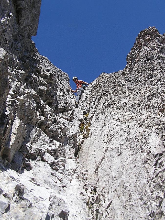 |
The rest of the ascent from that flat section consisted primarily of 3 or 4 chimneys which were fairly steep but easily doable. I just can't remember doing so much stemming ! Click on the pic for a full portait sized picture. |
|
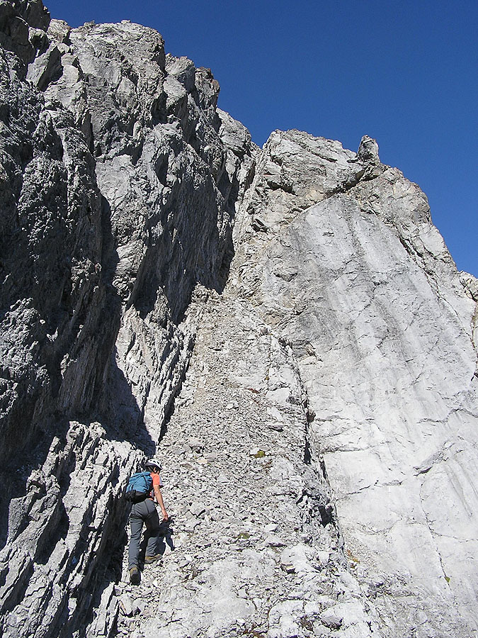 |
Maybe it was Makoto's routefinding but apart from the section with the 2 pitons, the rest of the ascent seemed like a regular slog with the occasional bout of exposure. Whenever we came to a section which looked questionable, we'd simply look to our right and find an easier ascent route. (Just like the drawing by Kane illustrates.) The array of cairns and rocks (wrapped in flagging tape) confirmed that we were on the right track. Click on the pic for a full portait sized picture. |
|
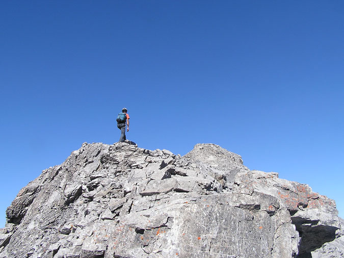 |
Once on the ridge, it was a simple hike to the summit with maybe one rock wall which required climbing. Mind you, the summit wasn't as close as we expected but it was nice being able to walk with your hands at your side. |
|
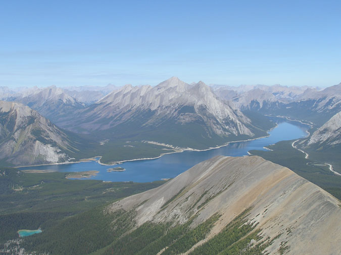 |
The Spray Lakes are looking mighty fine today. The view was similar to that of the Fist but with one difference. Assiniboine ! |
|
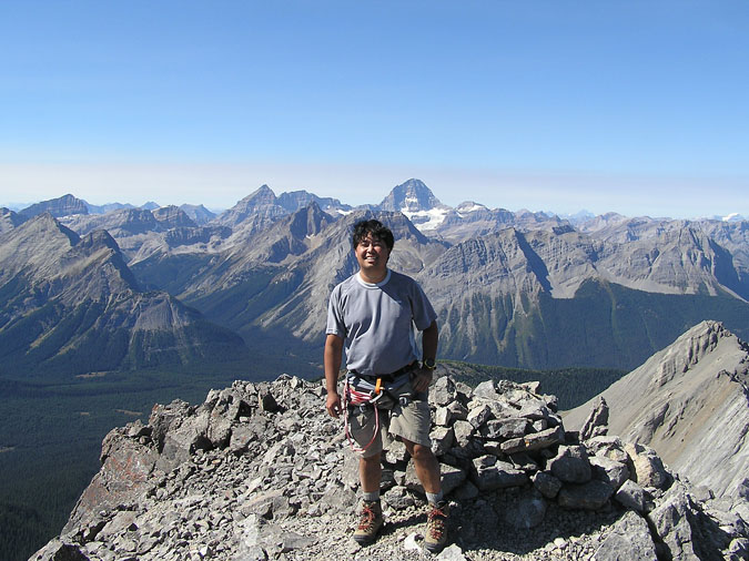 |
And here she is ... towering above me to the west. The summit cairn can be seen behind me but to my dismay, the register was missing ! I even searched the surrounding area in case it blew off but it was nowhere to be seen. No Kane register and no white water bottle register. The yellow pelican case was the only thing present but even that was missing one half of its contents. The laminated article of Van's demise was missing ! Makoto and I found it disturbing that someone may have kept that article for themselves. |
|
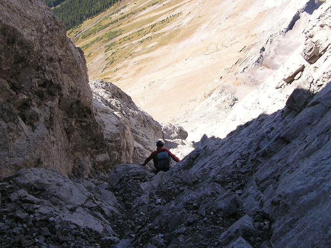 |
After almost 45 min at the summit, it was time to descend. Kane's suggestion of descending the first major gully to the left had Makoto saying, "You're joking right ? I'm not going down there !". So, we eventually made our way down the ridge to find a large cairn marking a gully which seemed a little more reasonable. Mind you, this wasn't a walk in the park either but at least we could see the bottom. The gully was really steep and strewn with loose rock so we took the first opportunity we could to get out and step onto the ledges which eventually led downwards. Interestingly enough, I found the descent to be a little tricker than the actual ascent. How ironic... |
|
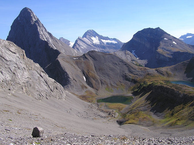 |
Here's a view of the Birdwood lakes with Mt. Birdwood and Sir Douglas dominating the skyline. In summary, I have to say that Mt. Smuts was probably the hardest scramble I've done to date. However, it was a lot easier than I thought. I guess it's possible that I may have overestimated this peak after reading the many trip reports but I can only surmise that the people who found this peak to be overwhelming must have taken a different route up this peak. ie. Following the crest of the ridge as opposed to the excellent system of gullies on the right. As for Makoto, he seemed entertained on this peak... except for the approach. I'm not sure if he'll ever join me again on a scramble but he did agree to lead any alpine rock route I wanted. SE Ridge of Fable, here I come ! :) |