
 |
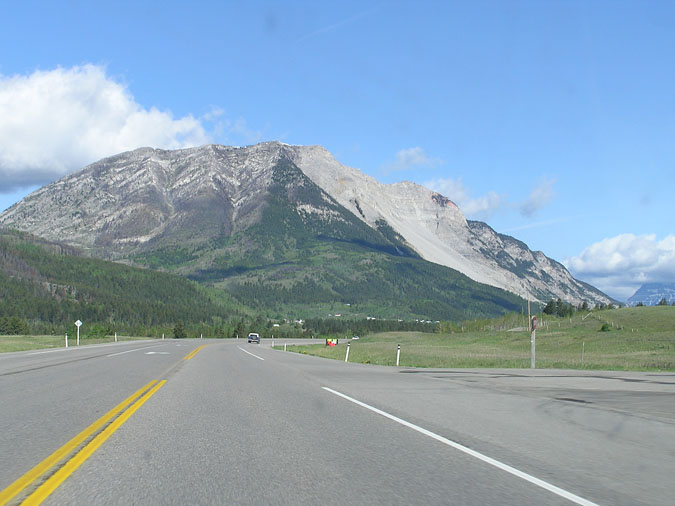
Longview Jerky. Ever since I sent a few packages to my family in Toronto last month, they've been raving about it at every opportunity ! Therefore, I wasn't surprised when they asked me to bring back a lot more during my visit to Toronto in late May. Driving 2hrs to buy a few packages of jerky seemed like a waste of time so I decided to take this opportunity to go the extra distance and return to Crowsnest Pass. My goal for the day would be Turtle Mountain - a peak which eluded me last month due to excessive winds and snow. This time, I left Calgary at 7:00 and arrived at Blairmore for 9:30 so that I could get an "early" start on the mountain. Here's Turtle Mountain from Highway 3 as you approach it from the east. Interestingly enough, the webcam for Turtle Mountain at thepass.ca showed overcast clouds and snow along the upper half - even though the date and time were accurate. I've since noticed that the picture hasn't been updated for at least a week ! So much for relying on webcams before my departure. |
 |
Here's a drivers view of Franks Slide. I've driven by this area a countless number of times but it never fails to amaze me. Oh yeah, for the record, I don't recommend taking pictures while you're in a moving vehicle... if you happen to be the only one in that vehicle. ;) |
 |
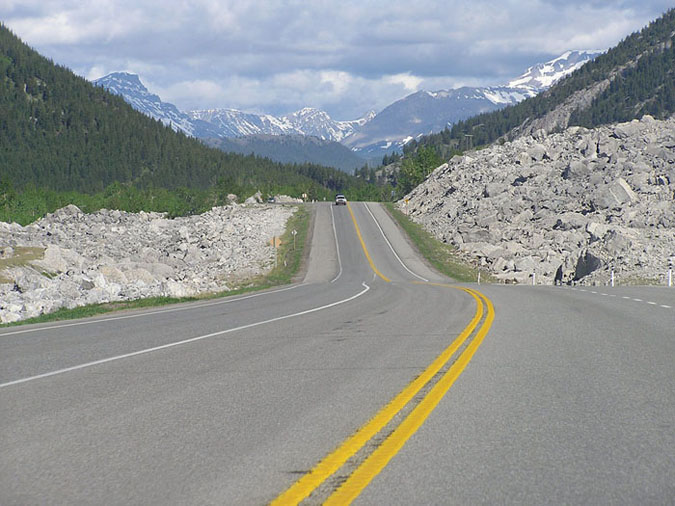
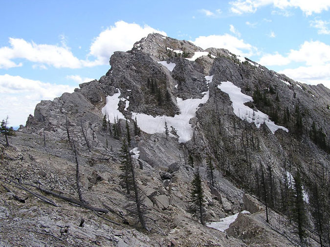
The first part of the scramble resembled Mt. Baldy in that it was relatively steep right from the parking lot. Luckily, that only lasted for around 30 minutes before it became a pleasant walk along a broad grassy ridge towards the first summit. Here's the final ridge to the first summit. Pretty long and steady but at least it was free of scree. |
 |
Here's another view of the plod up the ridge to the first summit. Probably the most boring section of the trip. |
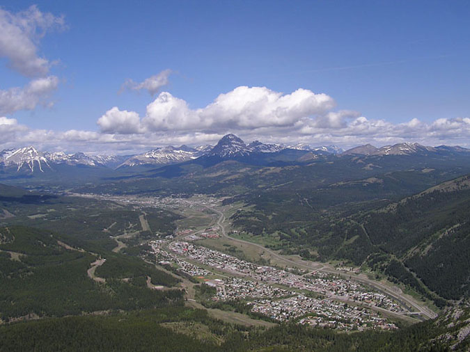 |
Here's a view of the town of Blairmore taken from the first summit. Crownest mountain can be seen in dead center as well. Blairmore has a population of around 2,000 so I found it to be an interesting coincidence that my brother in Toronto married a girl who was born in this small town. Oh yeah, it's also home to the worst Chinese food I've had in my life. I still remember the look on the chefs face as I walked in with my parents a few years ago. He had that look that said, "Oh shit ! I have to cook for some asians ?!" (Of course he wasn't an asian himself.) |
 |
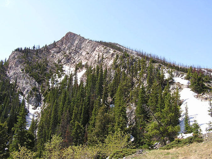
Upon reaching the first summit, I took a trail which went down and around to the main summit. In retrospect, I should have just stuck to the upper ridge - which I did on the way back. Scrambling along the ridge was similar to Engadine in that it was a little exposed but very interesting as well. I eventually topped out at around 12:00 and took in the views of the scenery below. The summit itself was pretty pathetic with tons of instruments, solar panels, wires and even a helipad. To make things worse, the summit register/canister was missing an end along with all of its contents ! Argh !!! Ah well... either way, a summit register may have been useless anyways. Judging by the number of people I encountered on the way down (20+), a register would probably fill up every 2 or 3 months. |
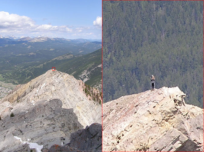 |
Here's a view of the first summit from the main summit. I saw someone standing on the summit so I took the opportunity to take advantage of the 30x zoom on my Olympus to take a stalker-esque snapshot. Hmm... I wonder if that guy/girl is doing the same thing to me... |
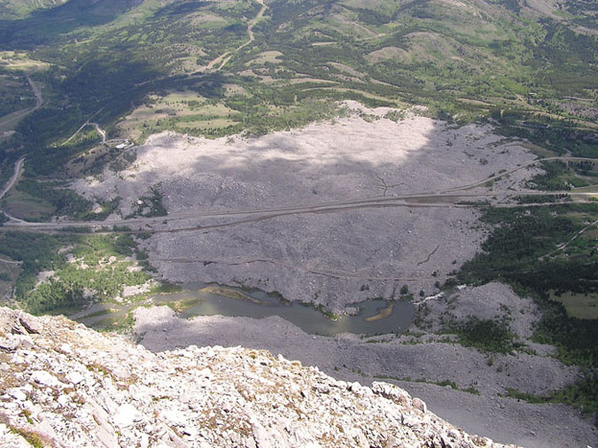 |
Finally, here's the view of the slide from the summit. Out of curiosity, I looked up the slide on Google Maps and found the following. And to think that I could have saved 5 hrs of driving and 5 hrs of scrambling for a similar view ! |